The Hardest Hike in Texas (and more) - Guadalupe Mountains, Texas
Getting There
I flew into El Paso, which is the easiest airport for accessing both Carlsbad Caverns and Guadalupe Mountains National Park. The airport is small and simple to navigate—just a short walk from baggage claim to the rental car counters. I rented a car from Enterprise Rent-A-Car and was on the road within minutes.
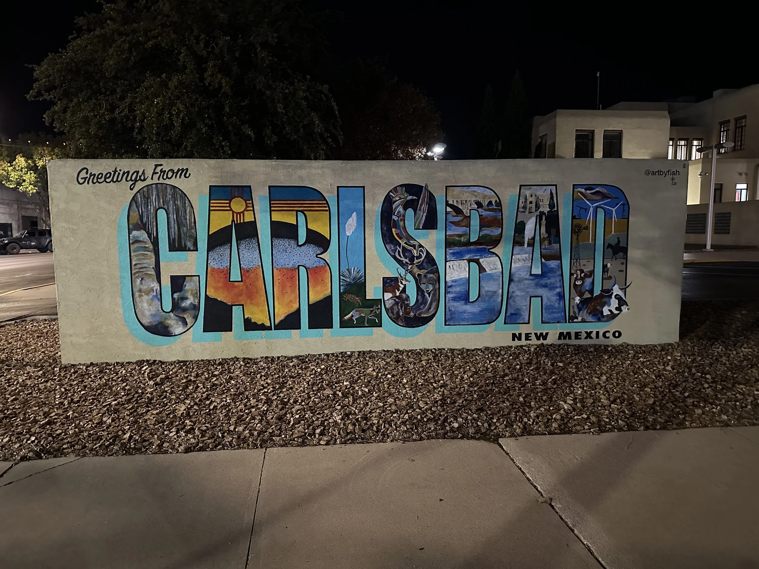
From El Paso, it’s a straightforward two hour drive to Carlsbad, New Mexico, which is the best base if you want easy access to the caverns and the Guadalupe Mountains without camping. It’s also where you’ll find the most consistent food options if you’re up early for runs or hikes.
Staying in Carlsbad, NM
I stayed at the Carlsbad Hyatt House, which is on the edge of town closest to both Carlsbad Caverns and Guadalupe Mountains National Park. It was well-rated, quiet, and made the early mornings easy.
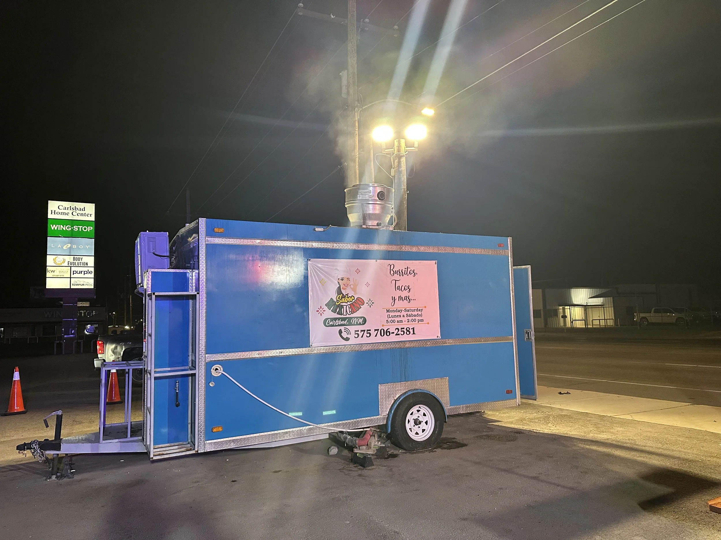
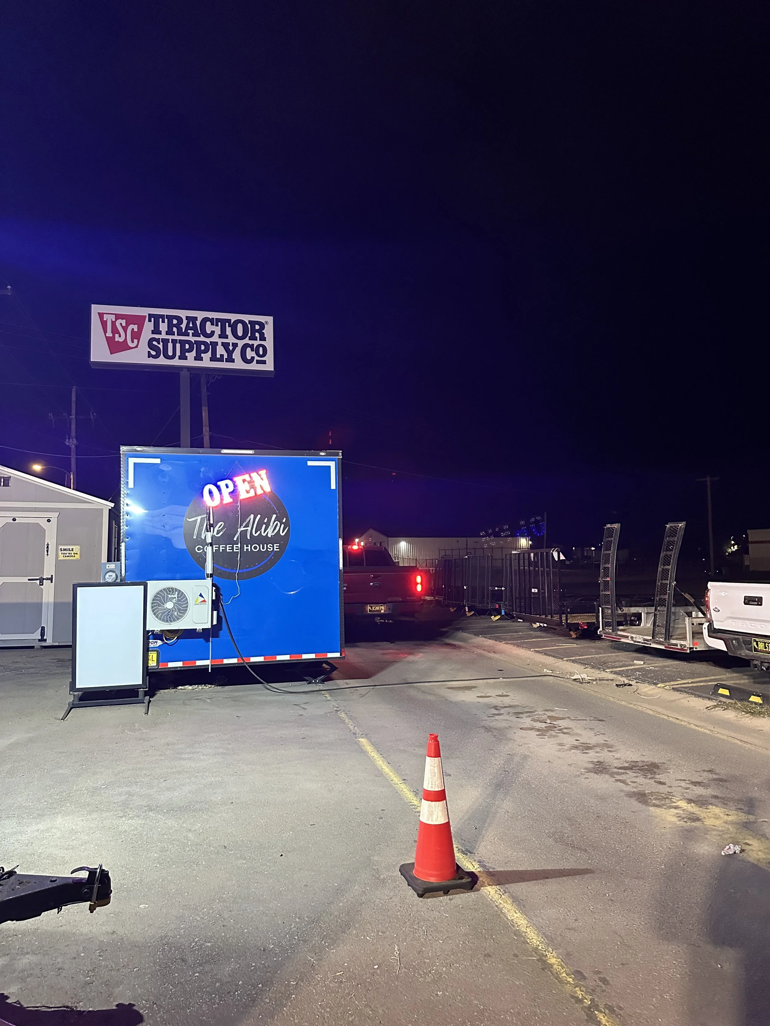
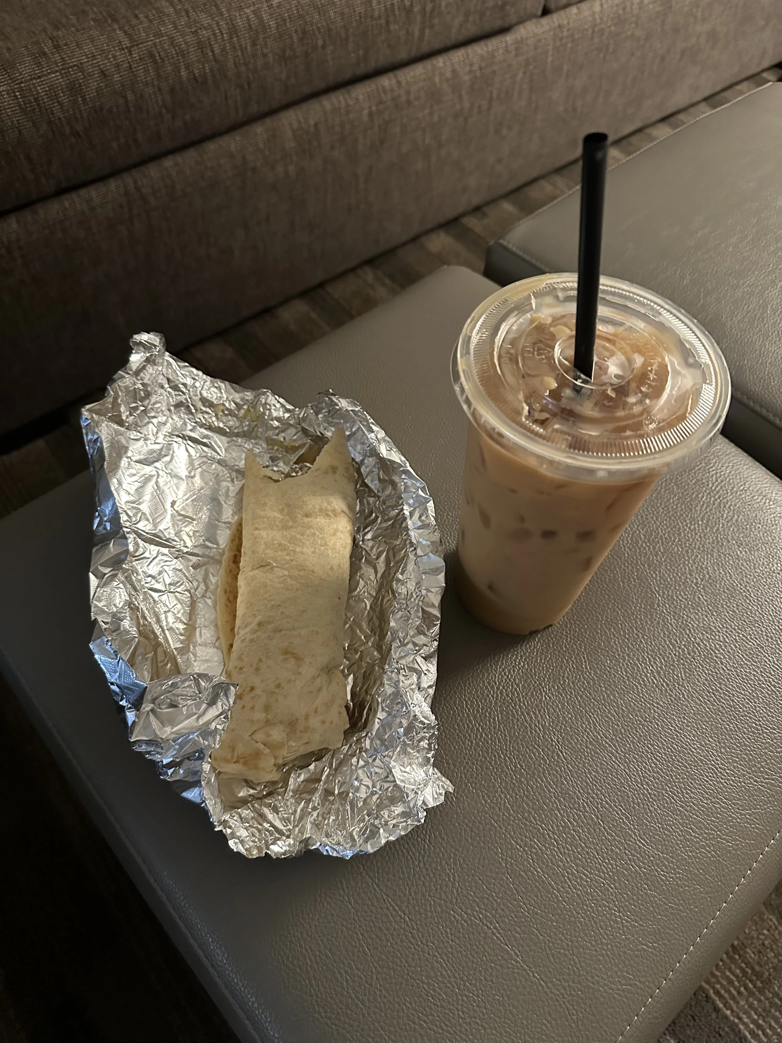
At 5 a.m., the only place reliably open for breakfast is the row of food trucks, where you can get a solid breakfast burrito and a large iced coffee—perfect before a morning hike. For dinner, I went to Yellow Brix, the most-reviewed restaurant in town. The pasta with salmon was a good pre-running meal. For dessert, I stopped by Kaleidoscoops Ice Cream, which I had heard about from a radio ad while driving around town.
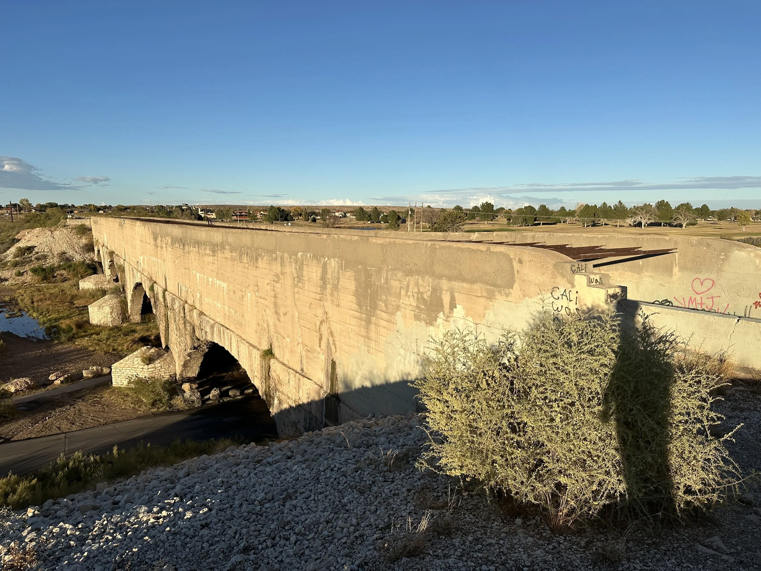
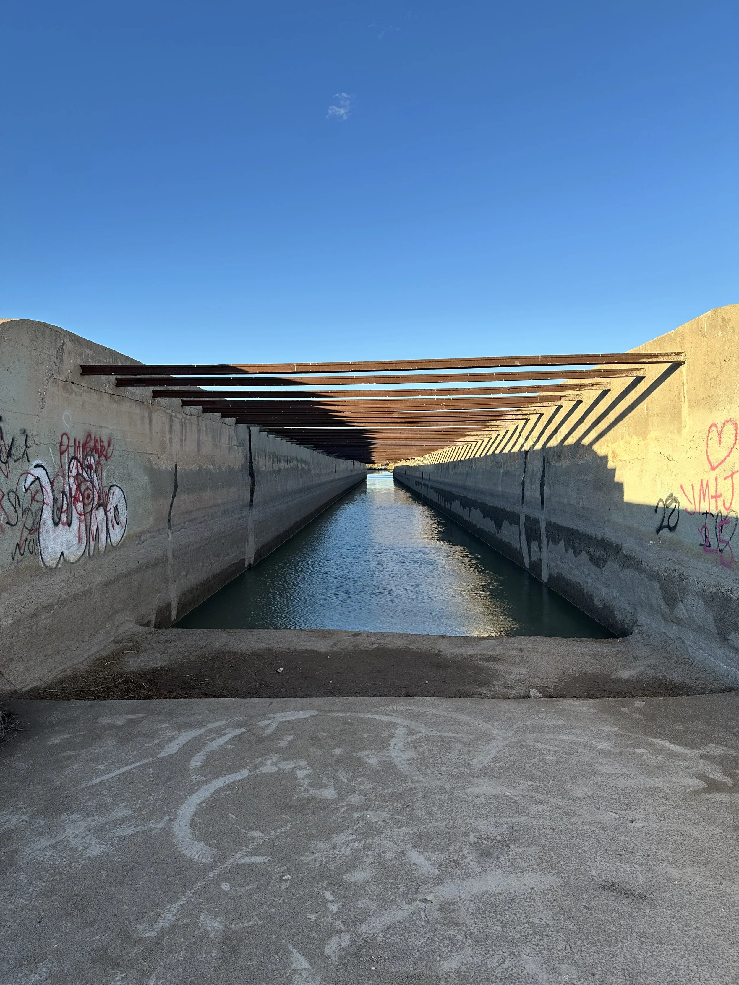
There is also one cool civil engineering feature in town, the Carlsbad Flume, sometimes called the “Pecos River Flume”. It is an old concrete aqueduct that once carried irrigation water across the river, essentially a bridge built to hold water instead of people. It’s an unusual structure. When I visited, there was still water pooled inside the channel, which made it even more interesting as it is crossing a river with water. It looks like it still occasionally carries water during heavy rains or flooding, and you can picture how the whole structure would come alive when the Pecos swells. It’s a quick stop, but a neat one, especially if you like old infrastructure.
Day 1 – Carlsbad Caverns & Devil’s Den Trail
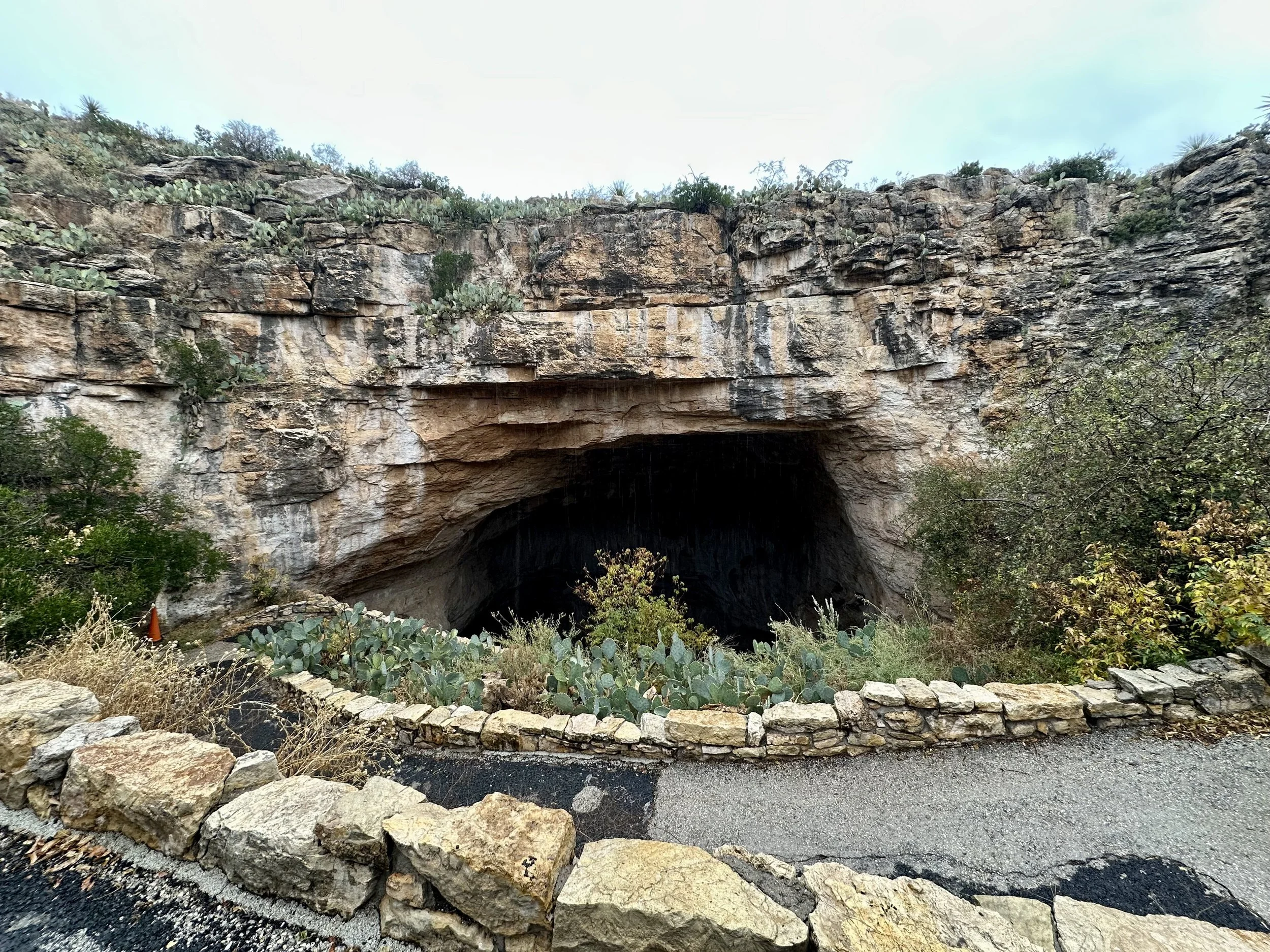
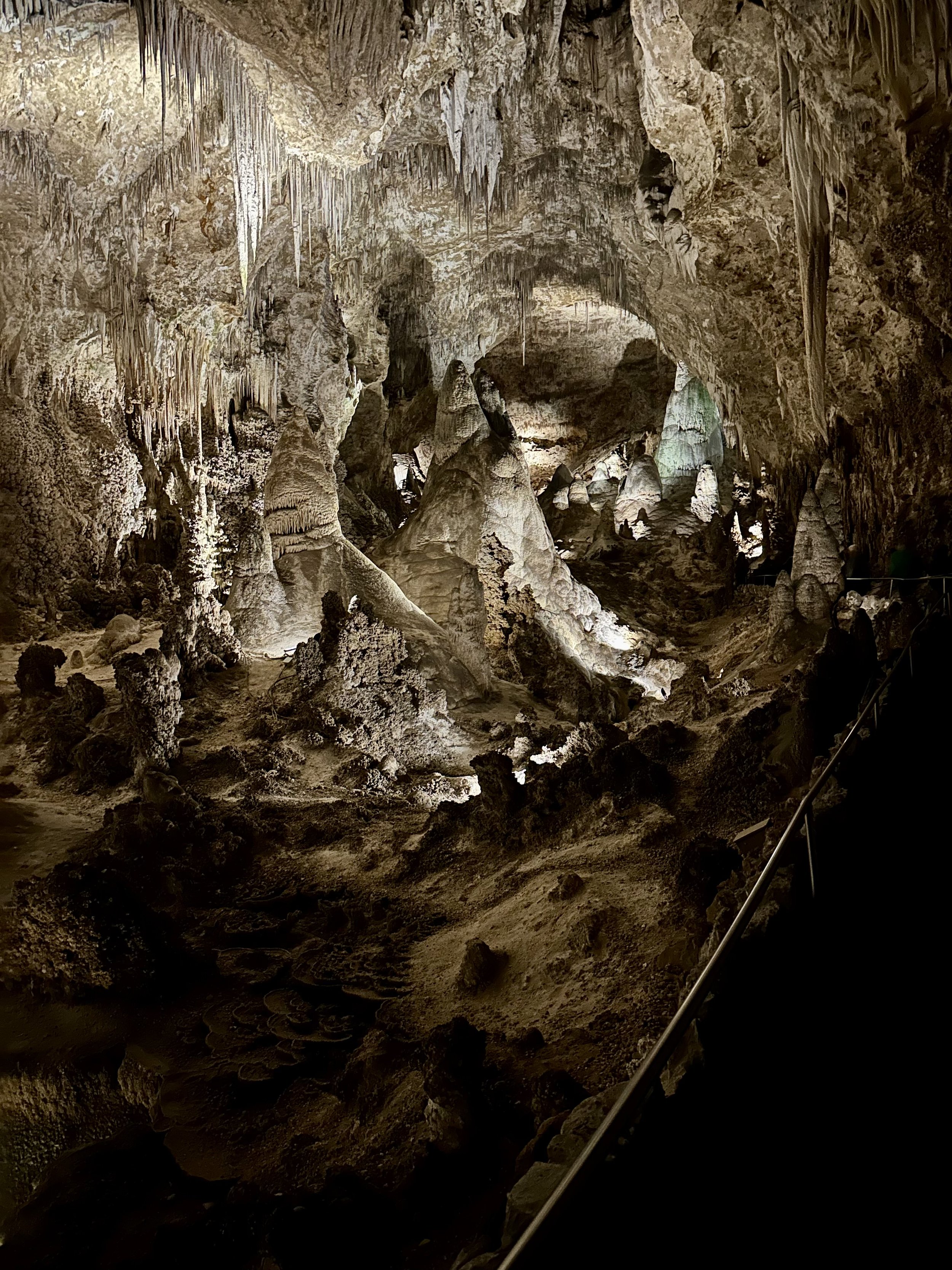
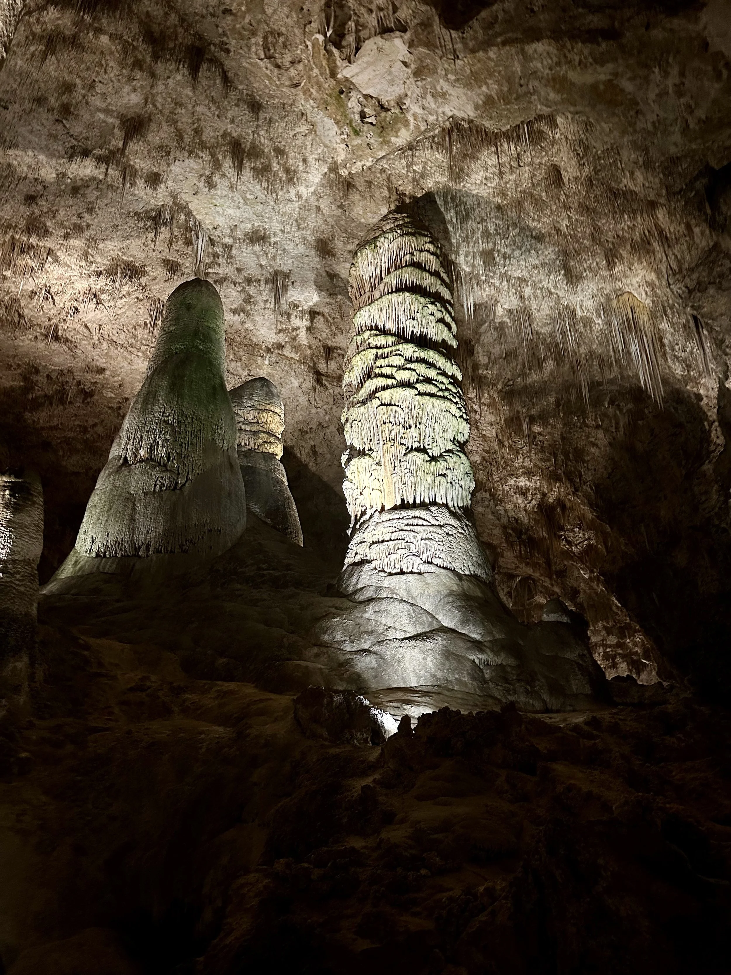
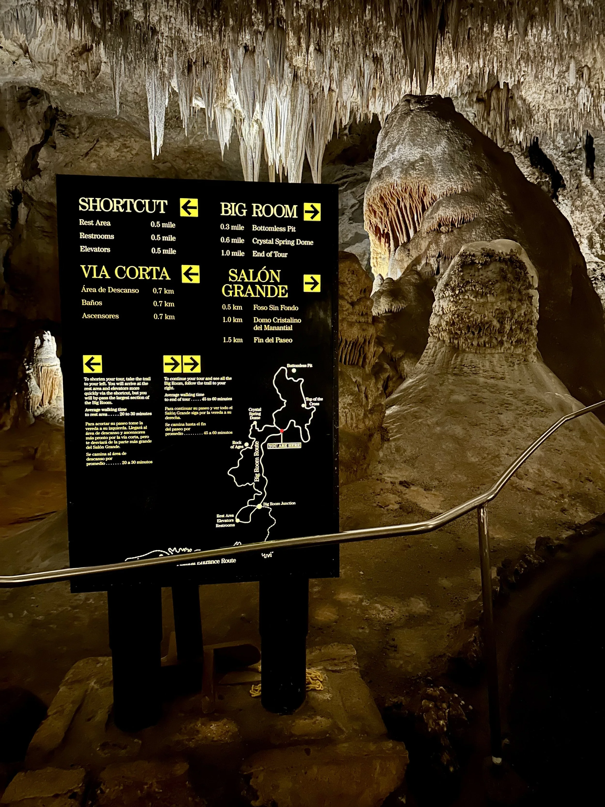
It was raining in the morning, so I decided to visit Carlsbad Caverns first. I joined a 9:30 a.m. entry group, but there were only a handful of people. For most of the two-hour walk through the caverns, I was completely alone.
The caverns are far bigger and more dramatic than I expected—huge vaulted rooms, quiet passages, and formations that feel otherworldly. It’s a long walk, but an easy one, and well worth taking slowly.
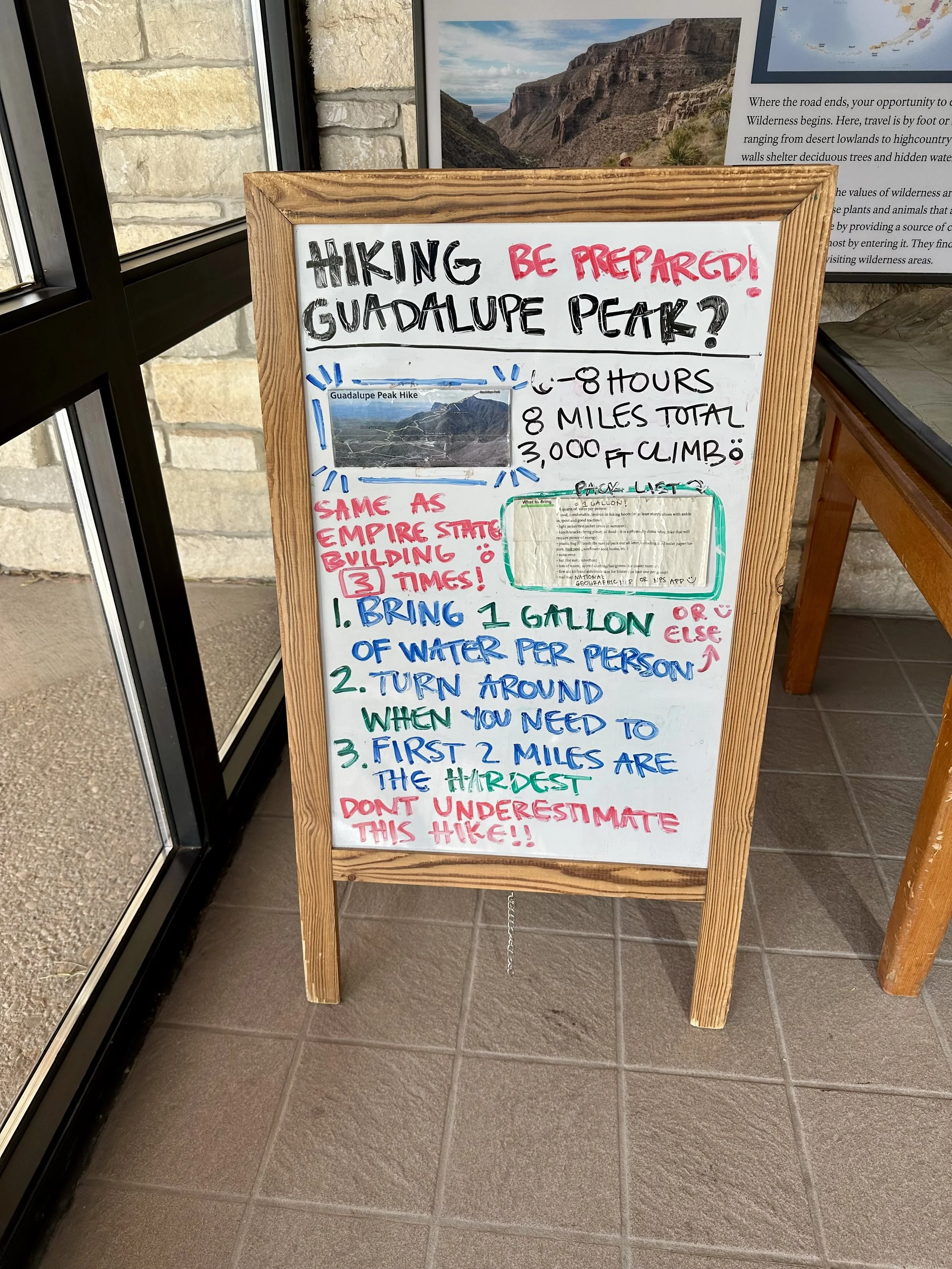
Afterward, I stopped at the Guadalupe Mountains visitor center to check on conditions. The ranger mentioned gusts up to 65 mph on the summit and recommended avoiding the peak. Instead, I went for the Devil’s Den Trail.
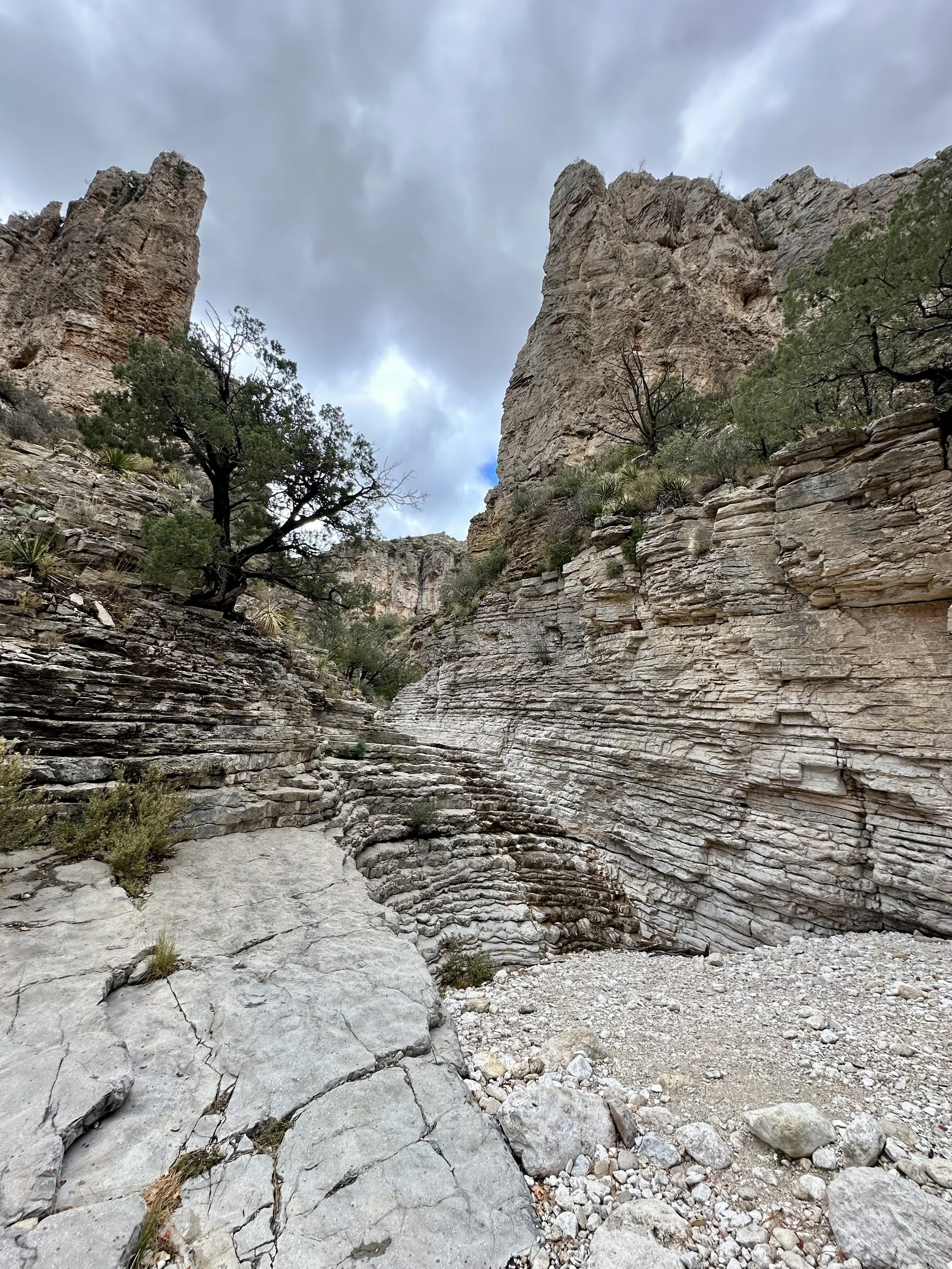
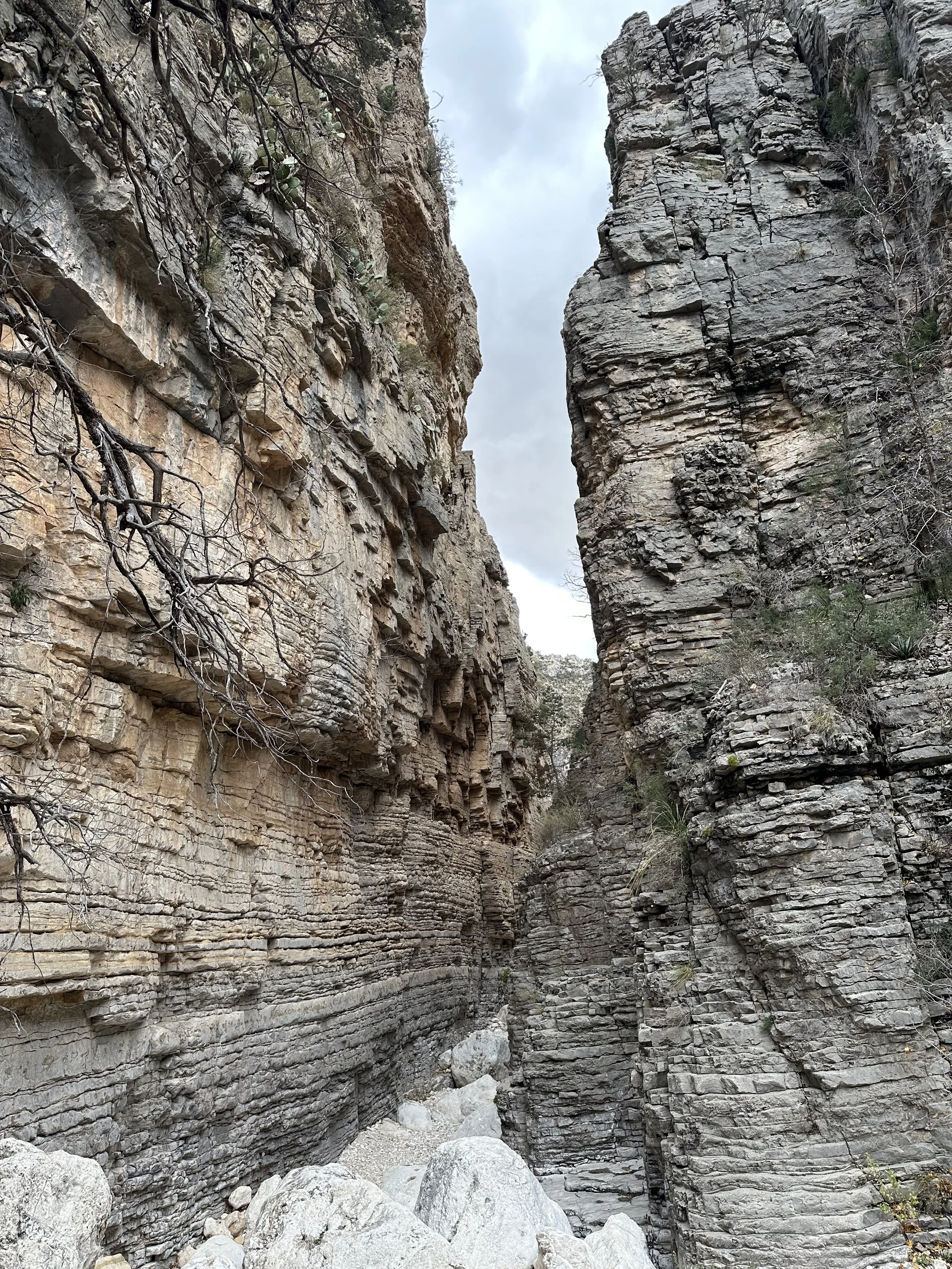
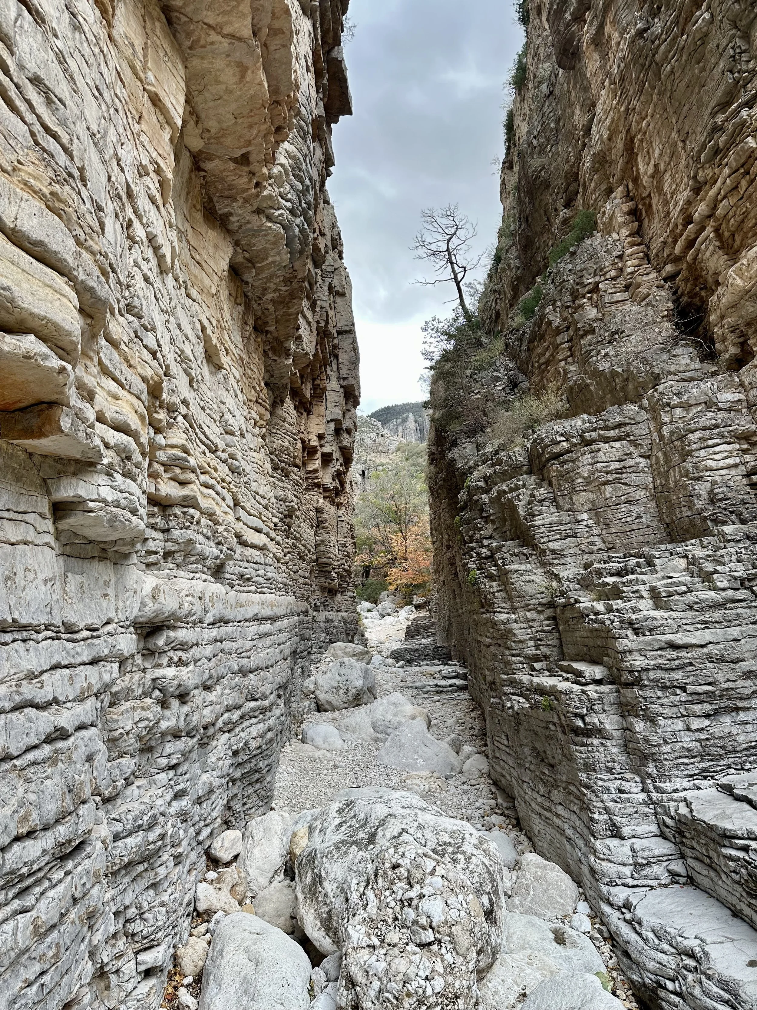
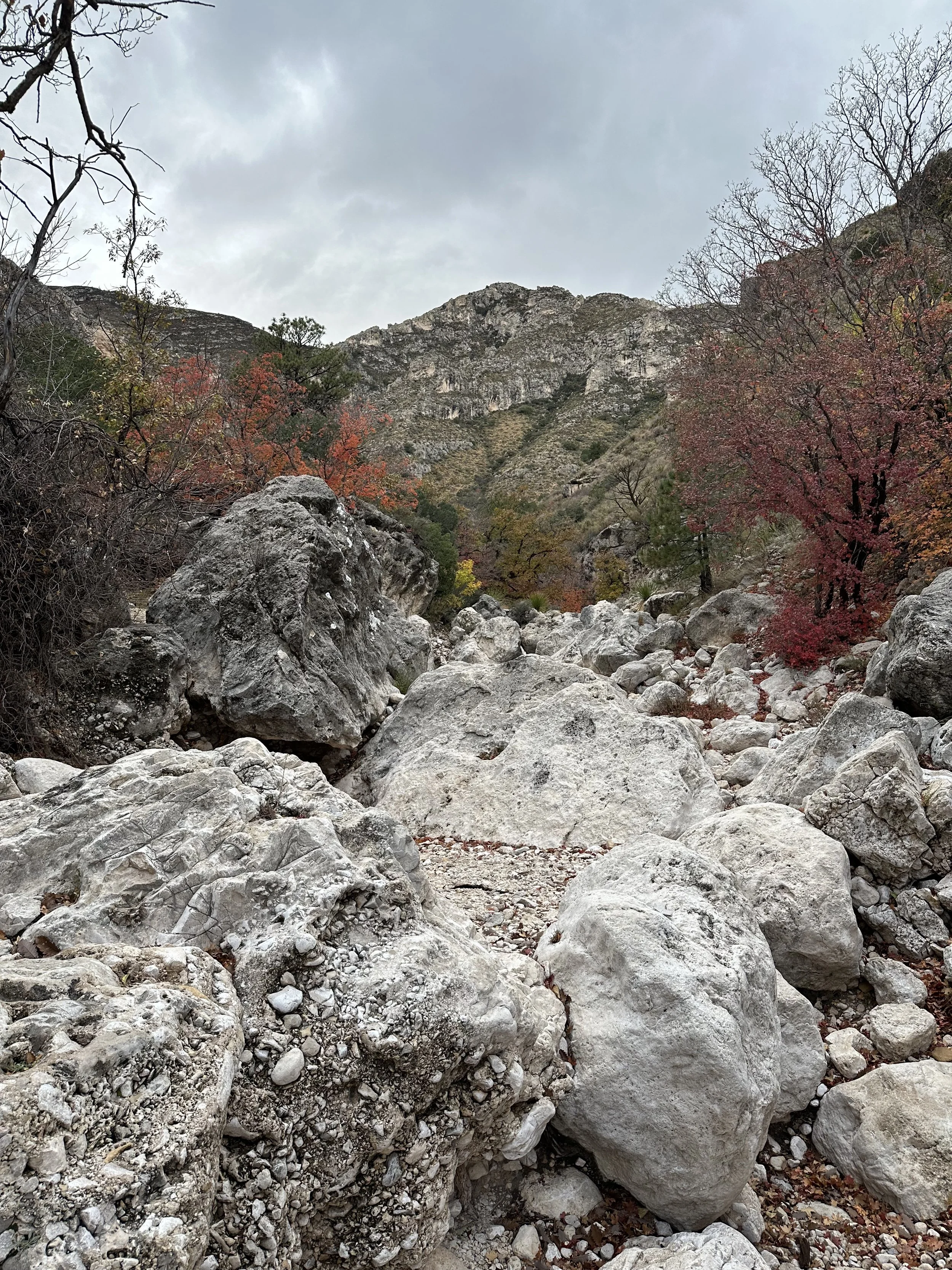
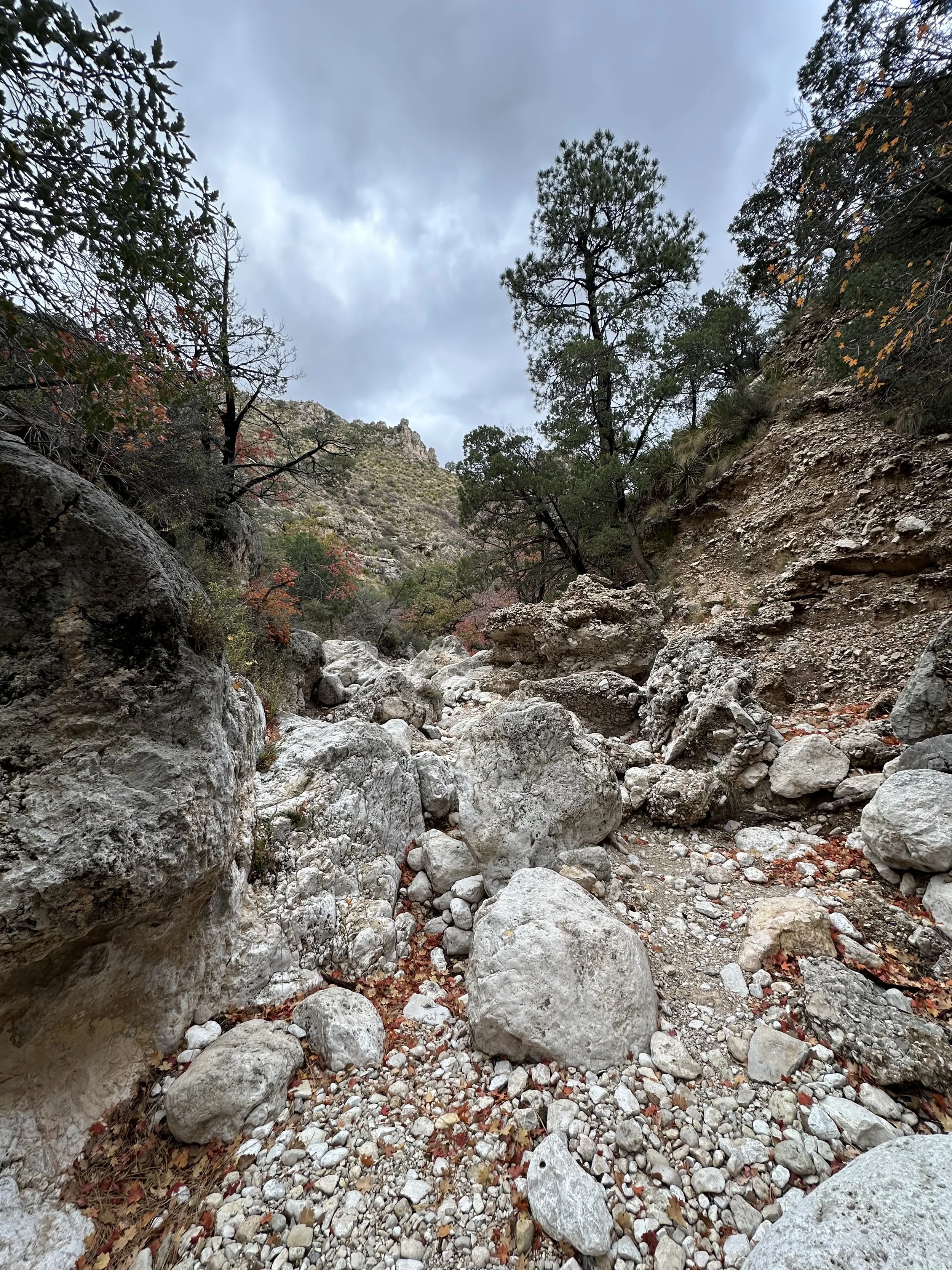
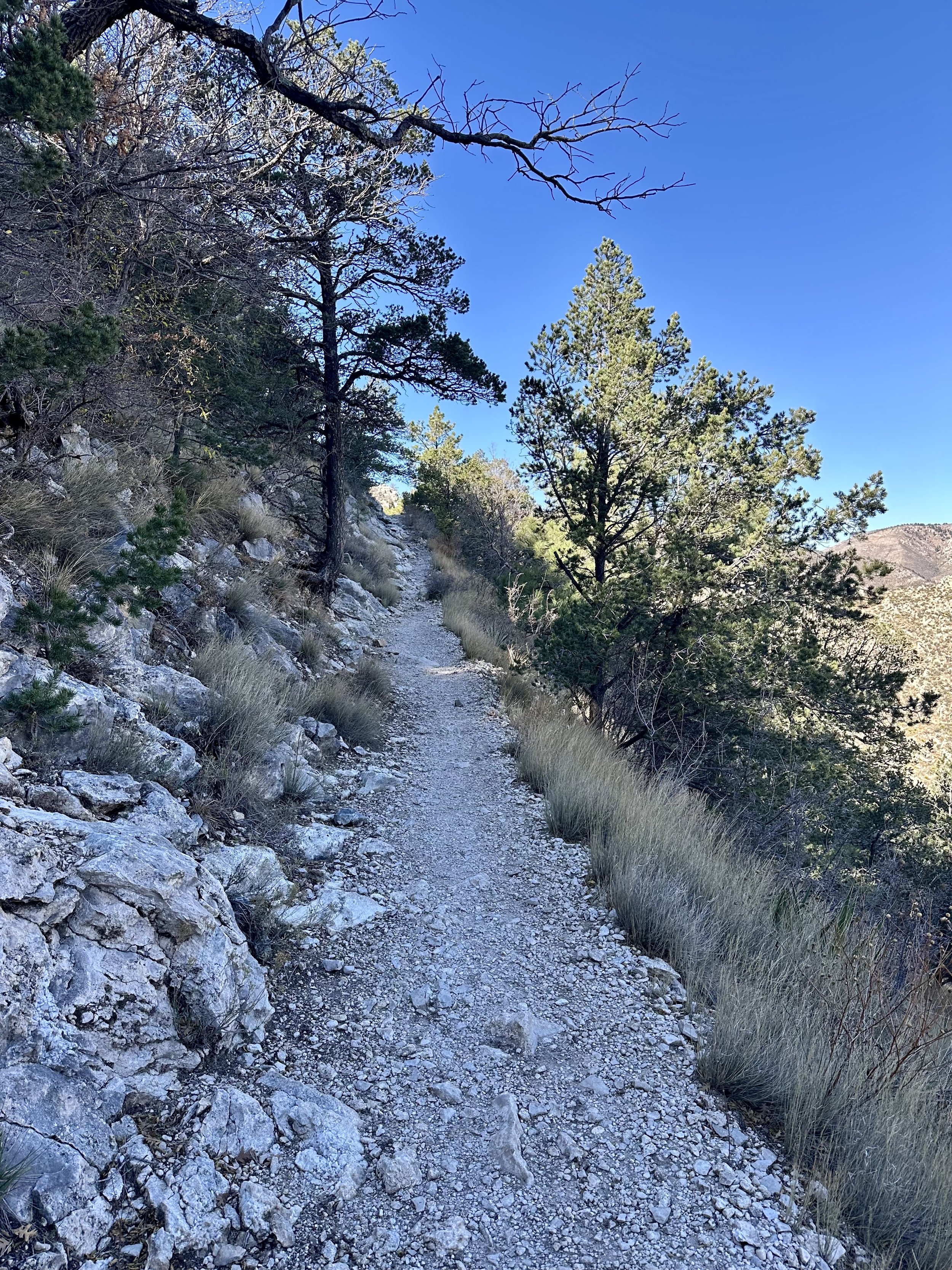
The trail starts as a nice stretch of singletrack before dropping into a wide wash—essentially a dry riverbed—that makes up most of the route. It involves light bouldering and a bit of route-finding. The fall colors in the canyon were peaking, and the mix of rock and leaves made it a very pretty hike.
The actual Devil’s Den is a narrow formation of shale-like rock with a deep groove cut through it. It’s short but fun, and the rock scrambles make it more engaging than the mileage suggests.
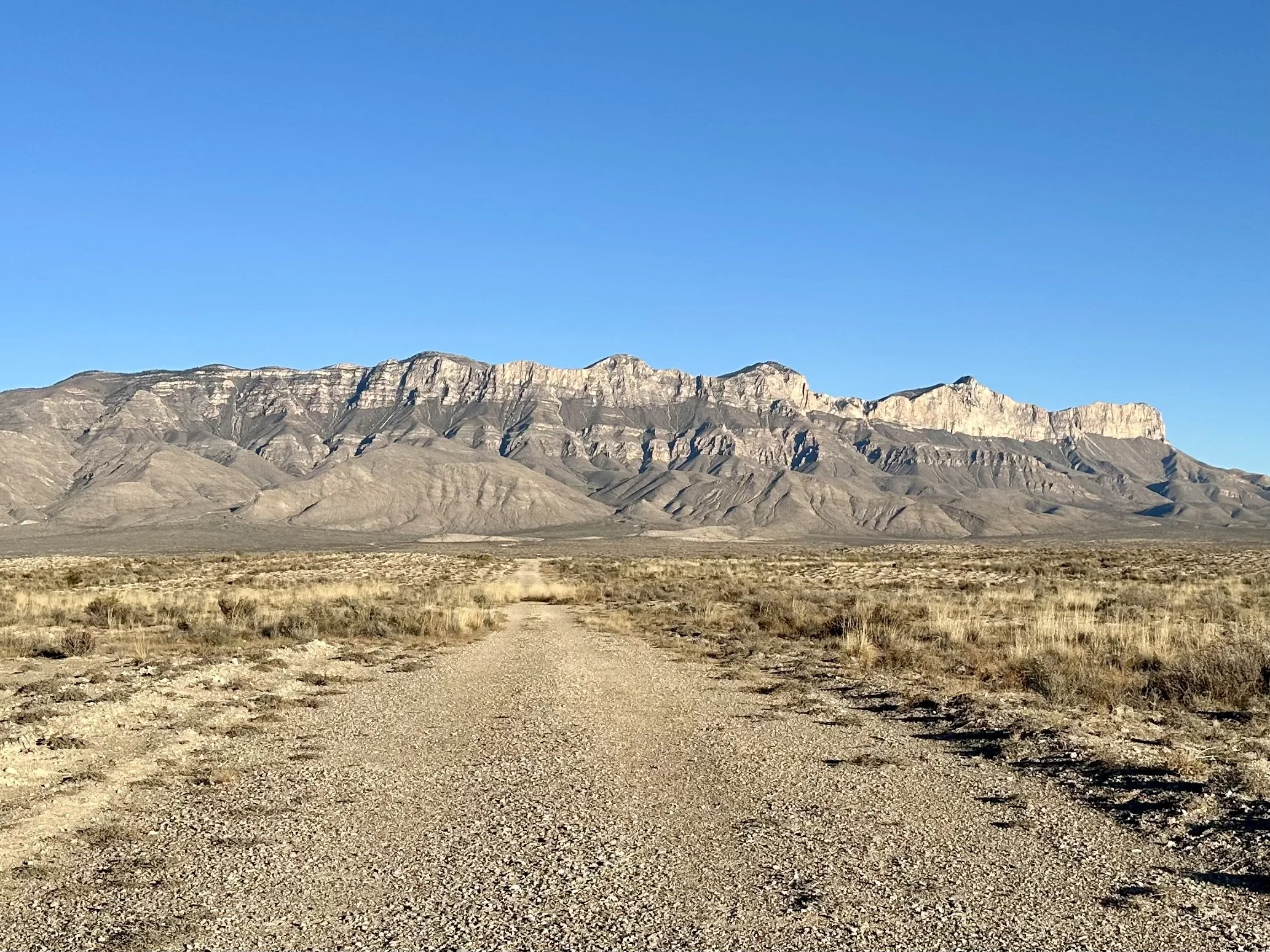
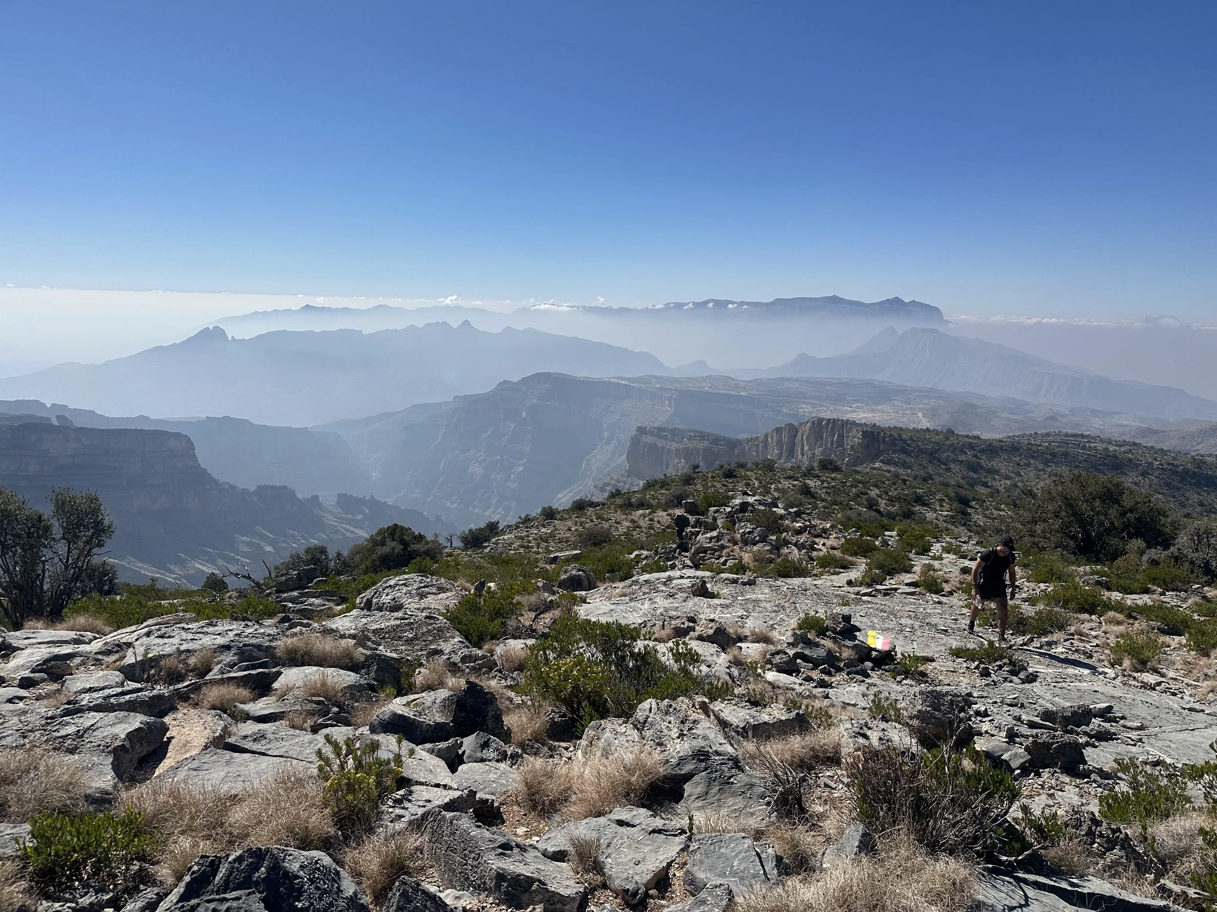
Day 2 – Guadalupe Peak & Salt Basin Dunes
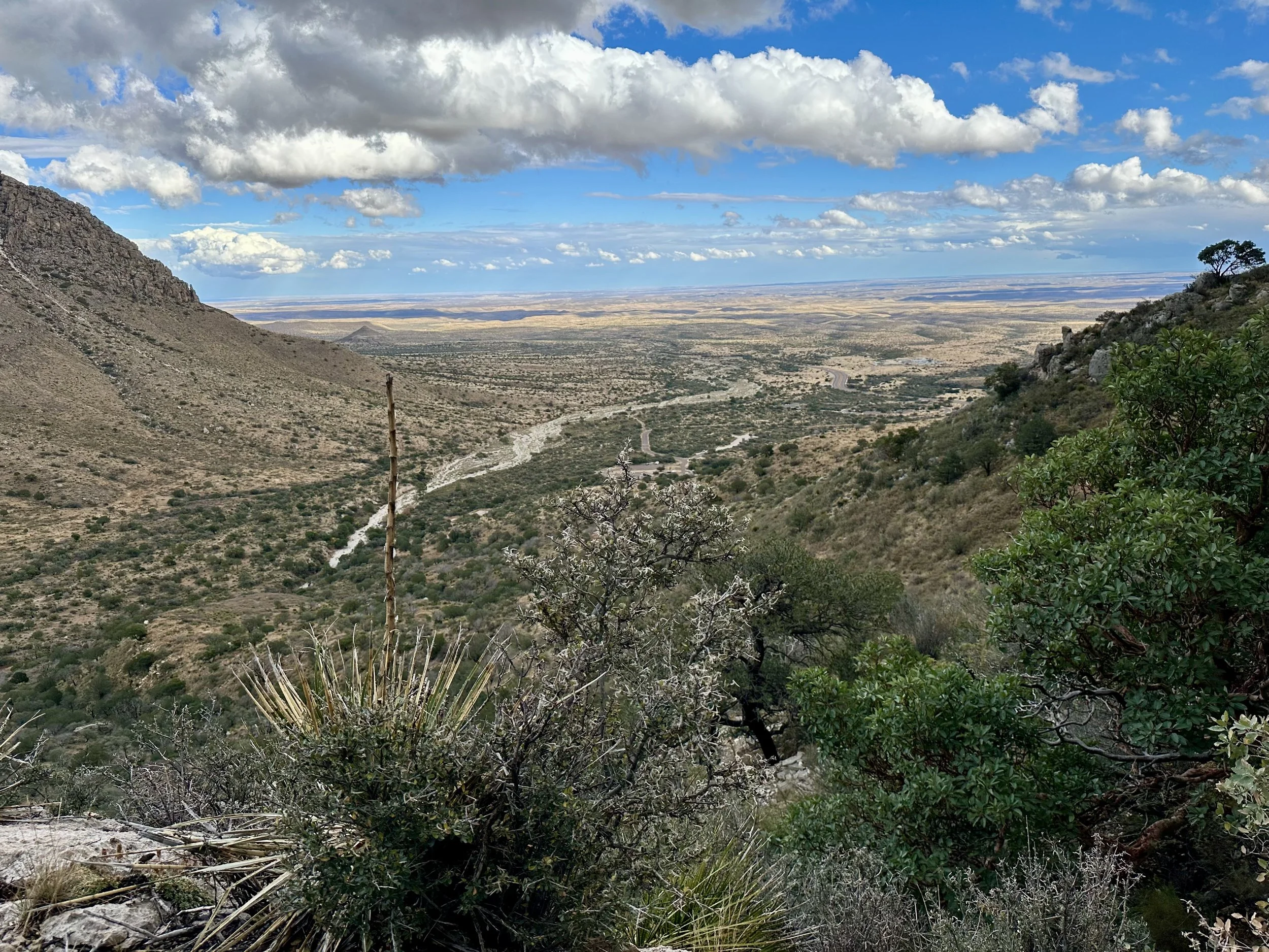
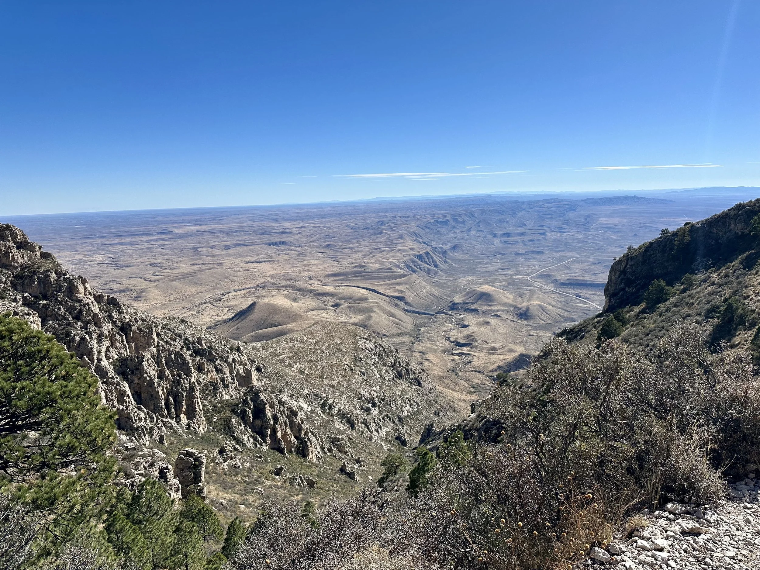
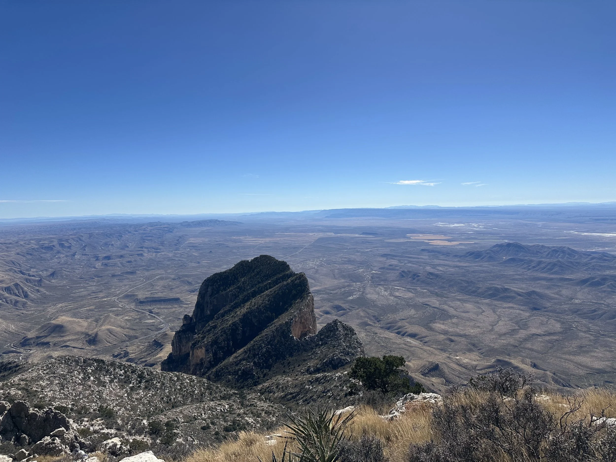
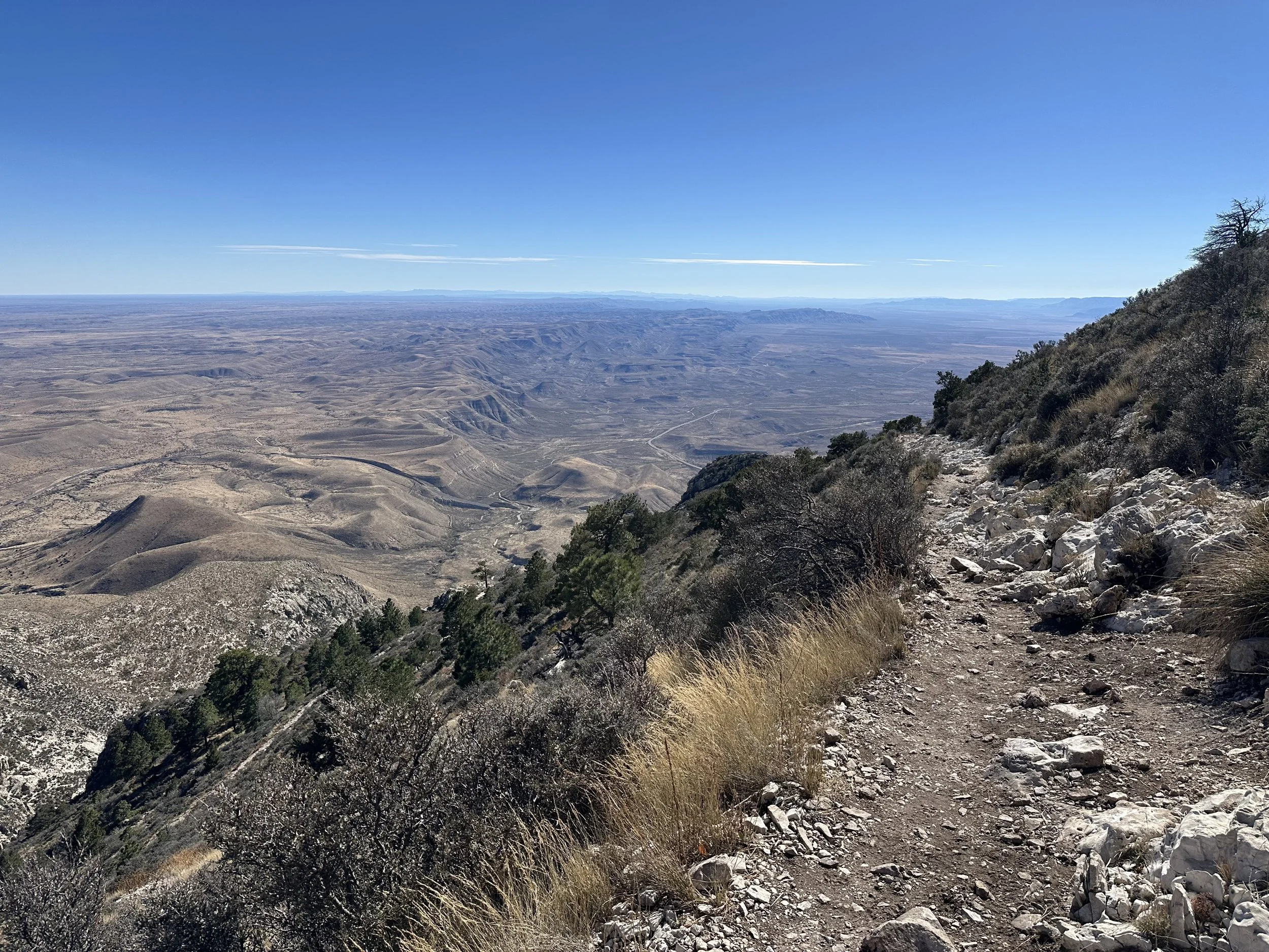
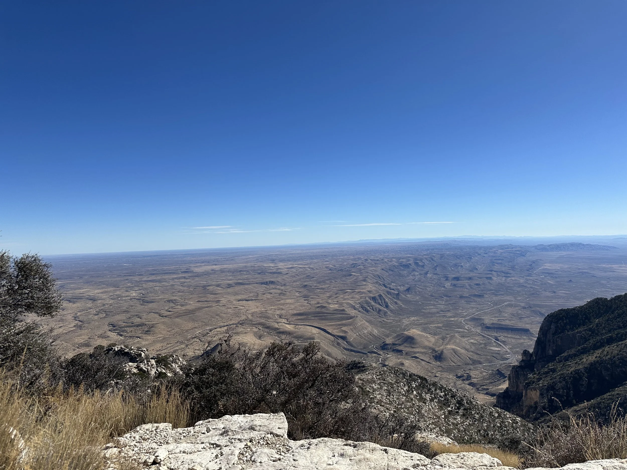
The next morning I headed out early for the Guadalupe Peak Trail. The Guadalupe Peak Trail is widely considered the hardest hike in Texas, and it earns that title through a combination of elevation, exposure, and nonstop climbing. The trail gains over 3,000 feet, starting at roughly 5,700 feet and topping out at 8,751 feet, the highest point in the state.
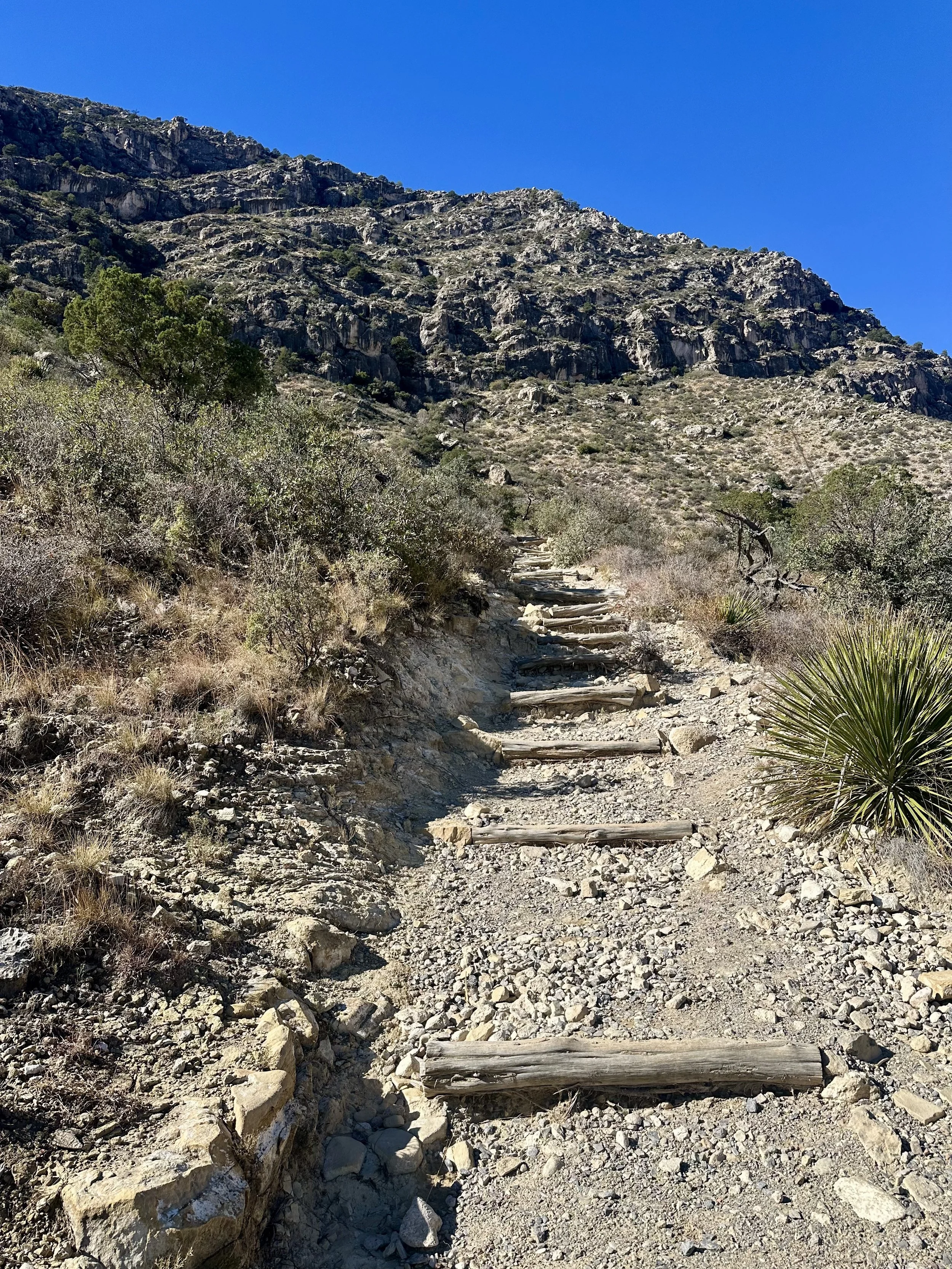
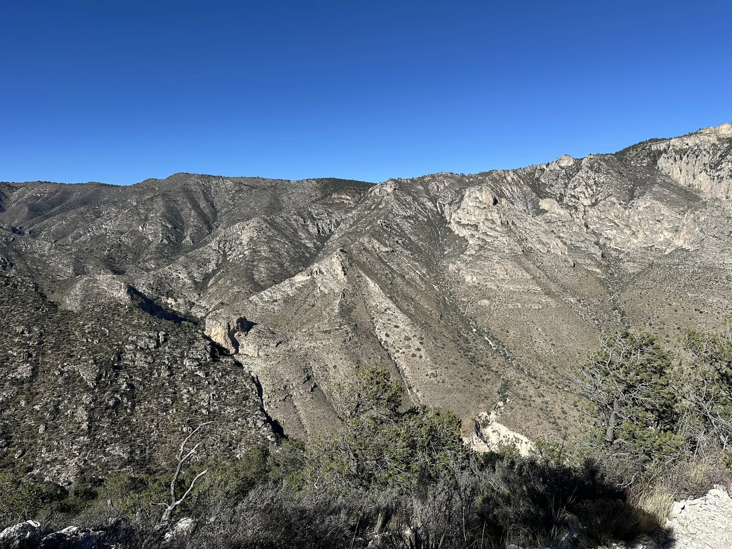
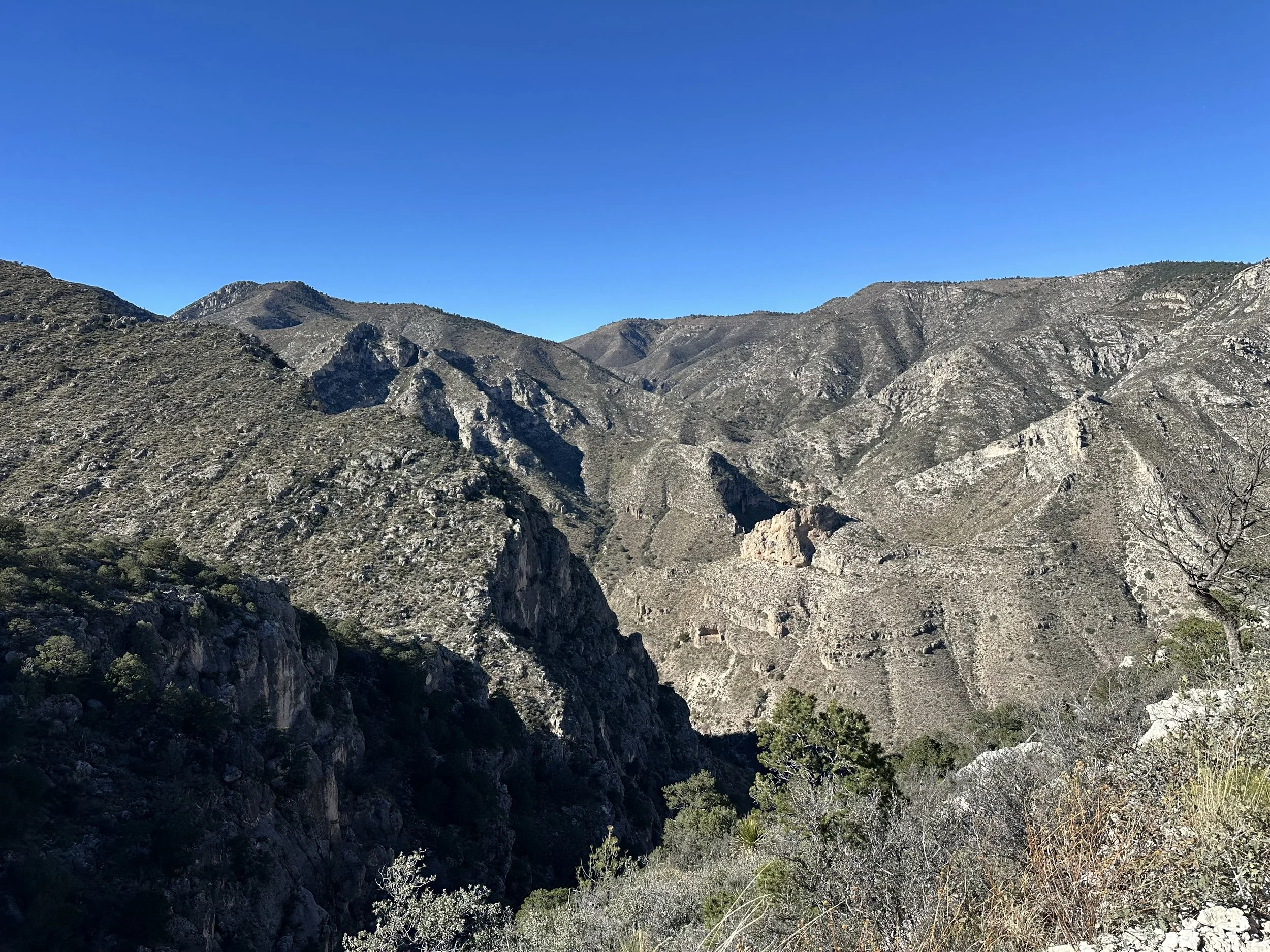
The day was clear and sunny, but with steady wind and occasional strong gusts. The first two miles are exposed but manageable. Right at mile two, the trail turns onto the backside of the range, and that’s where the wind picks up. I passed several hikers who decided to turn around at this point.
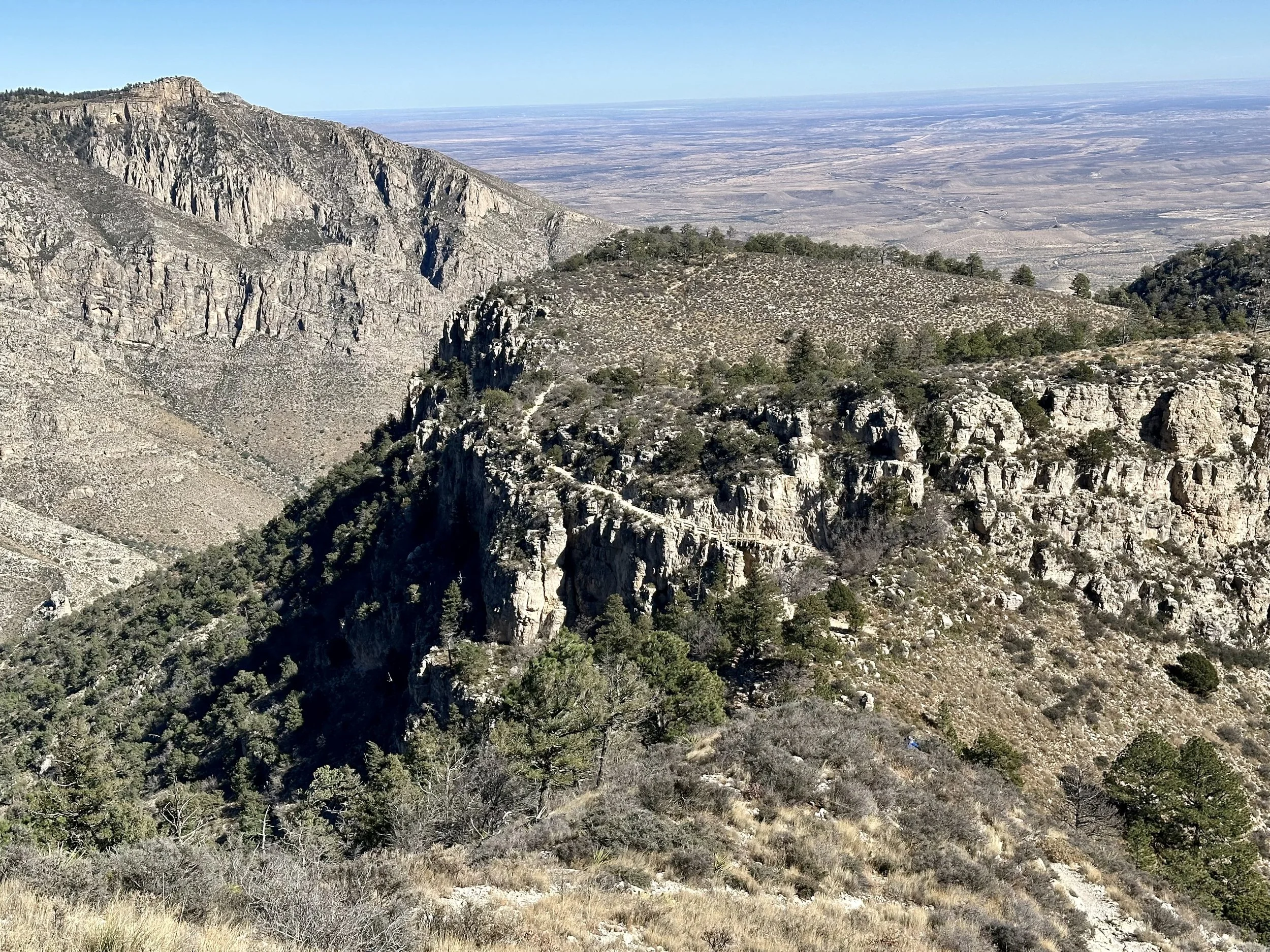
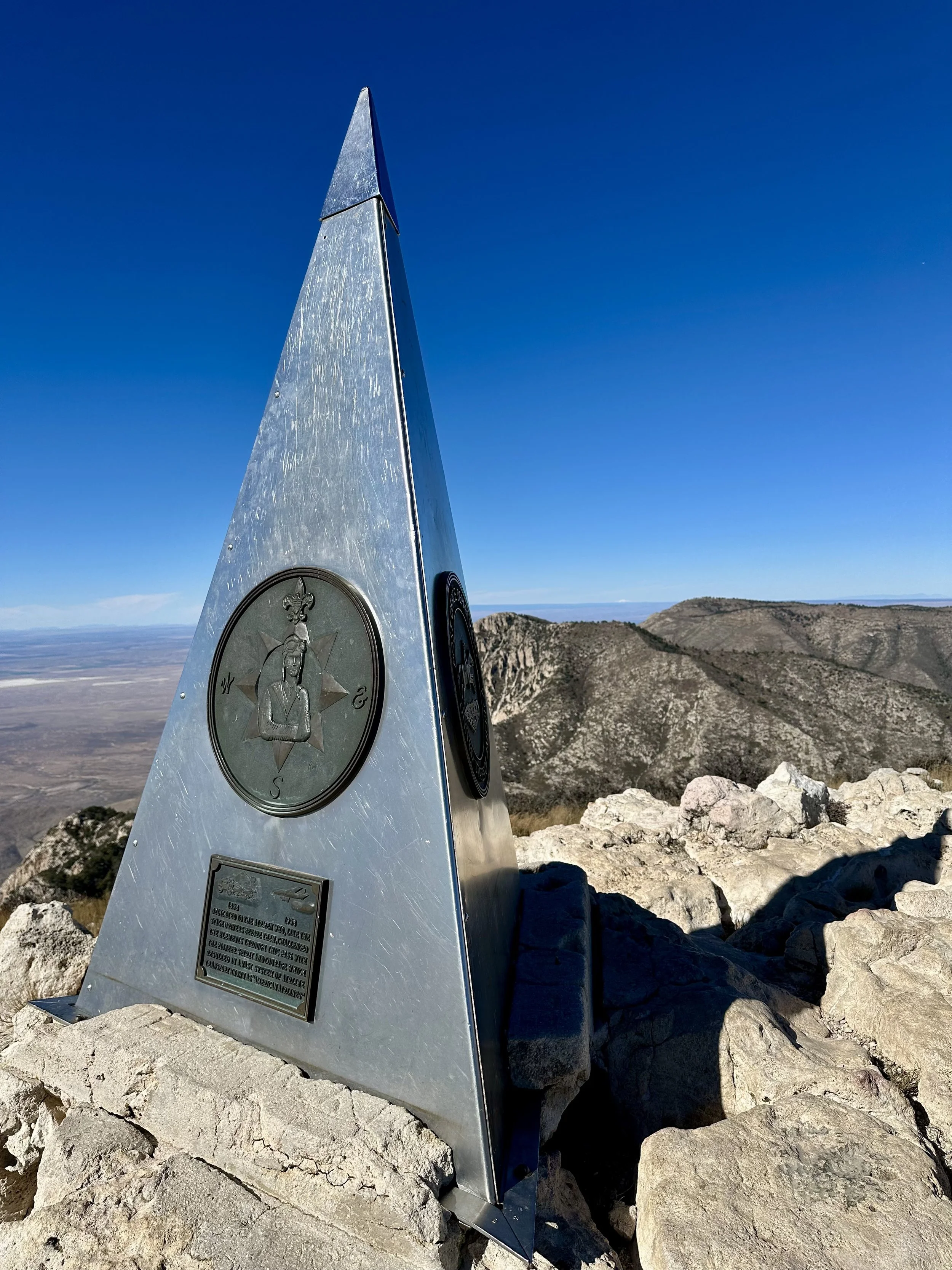
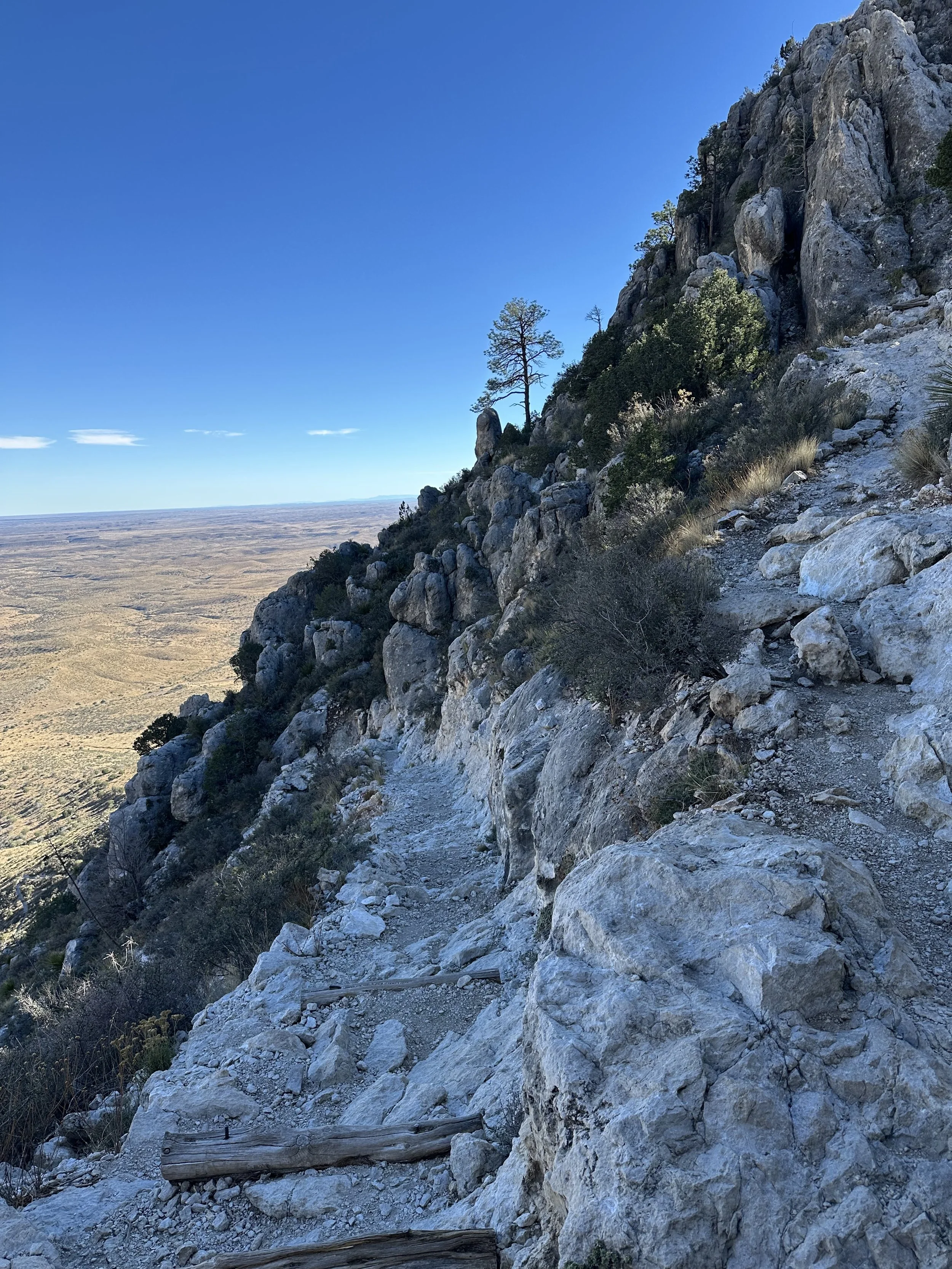
For the next couple miles, the trail moves into trees and stays sheltered until you approach the final ascent. The last section has some light scrambling but nothing technical. The summit offers a wide, clean view of the desert, and the metal monument makes for a great photo.
The descent is surprisingly runnable—smooth, switchbacked, and fun.
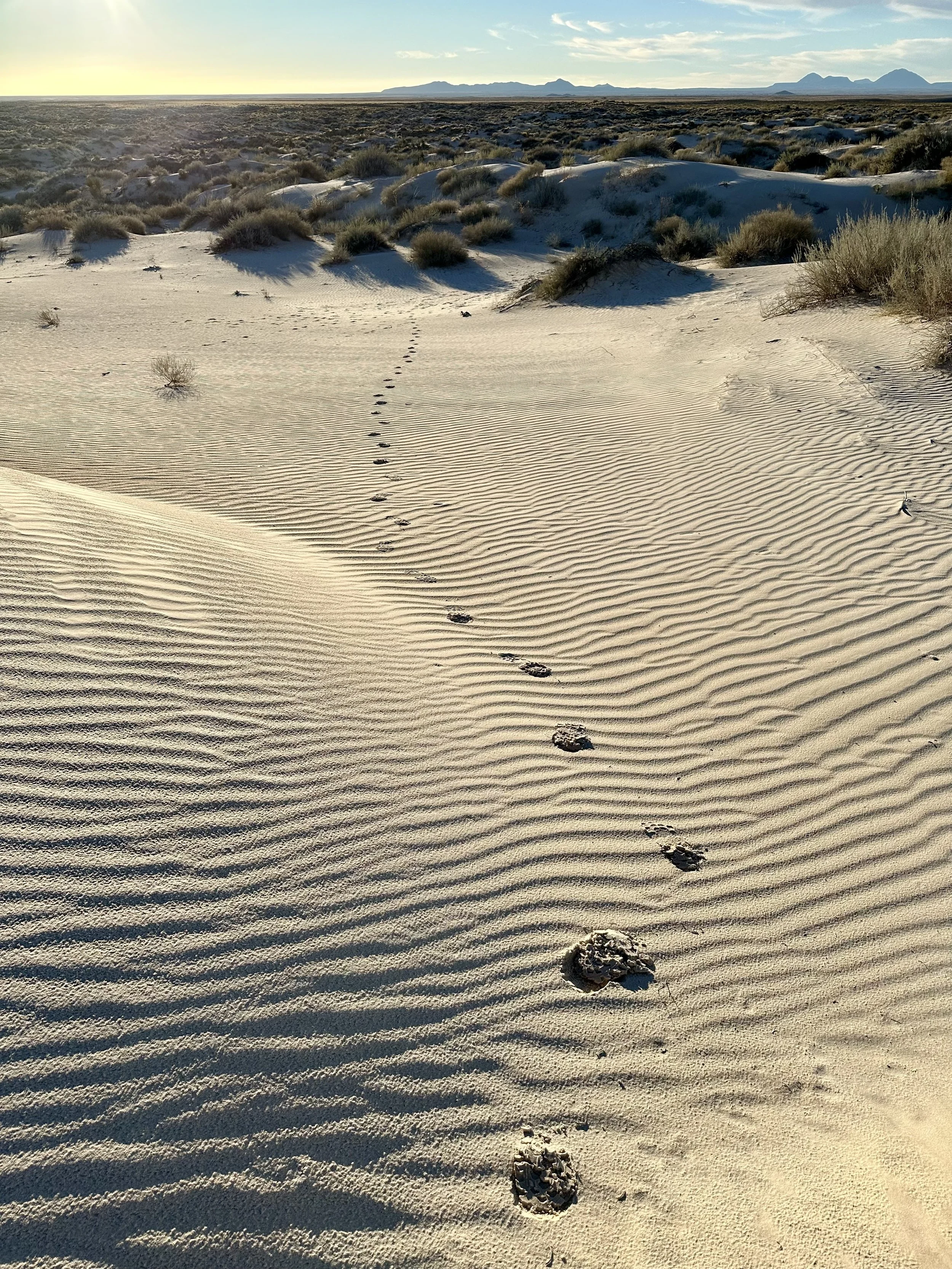
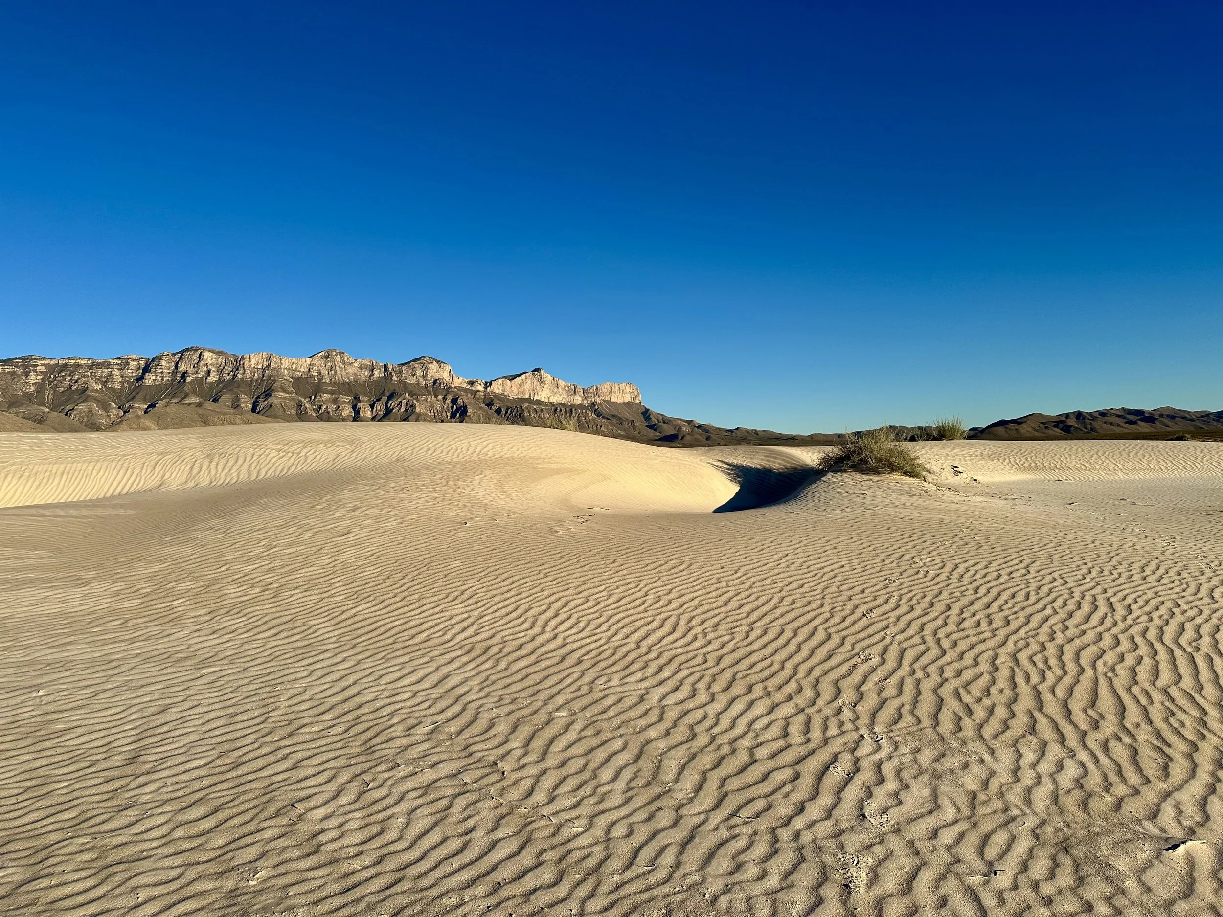
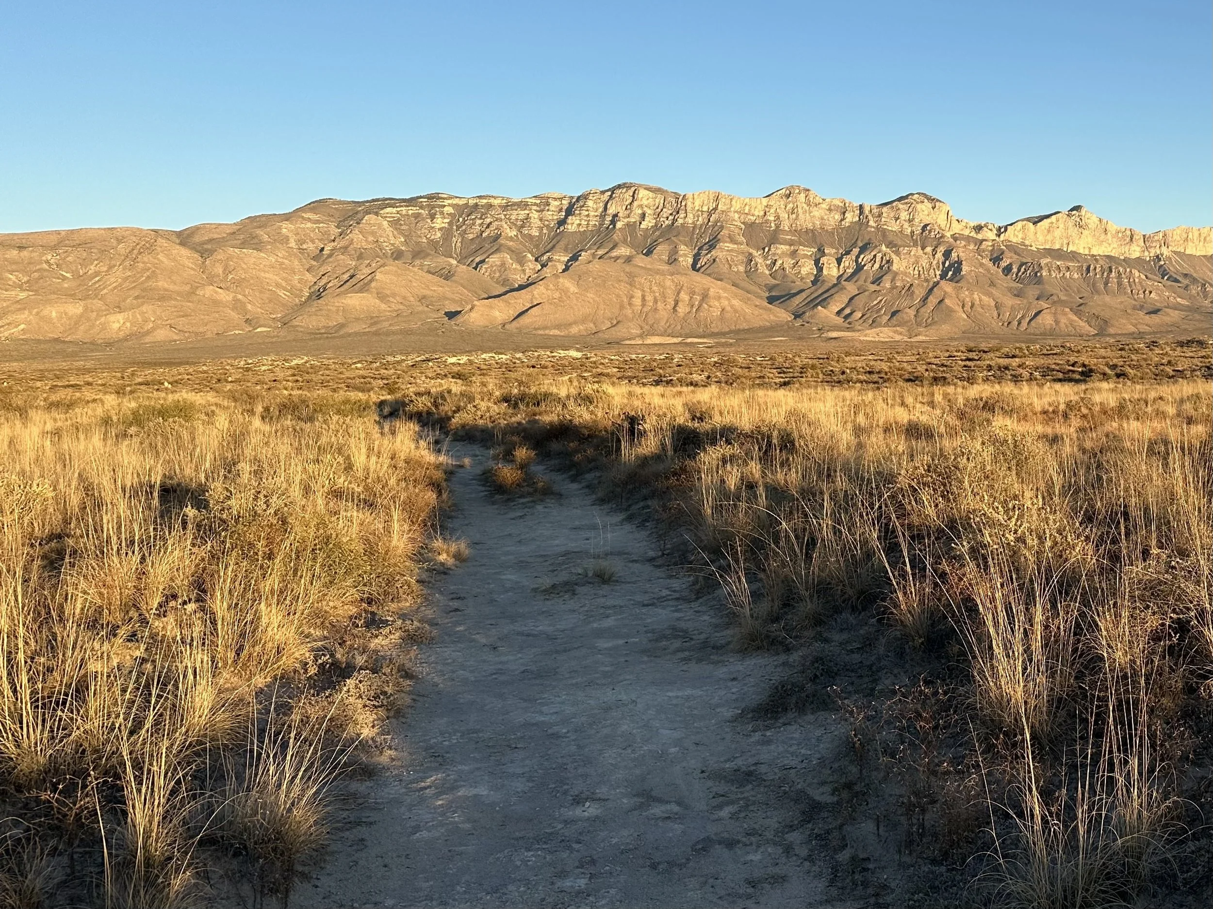
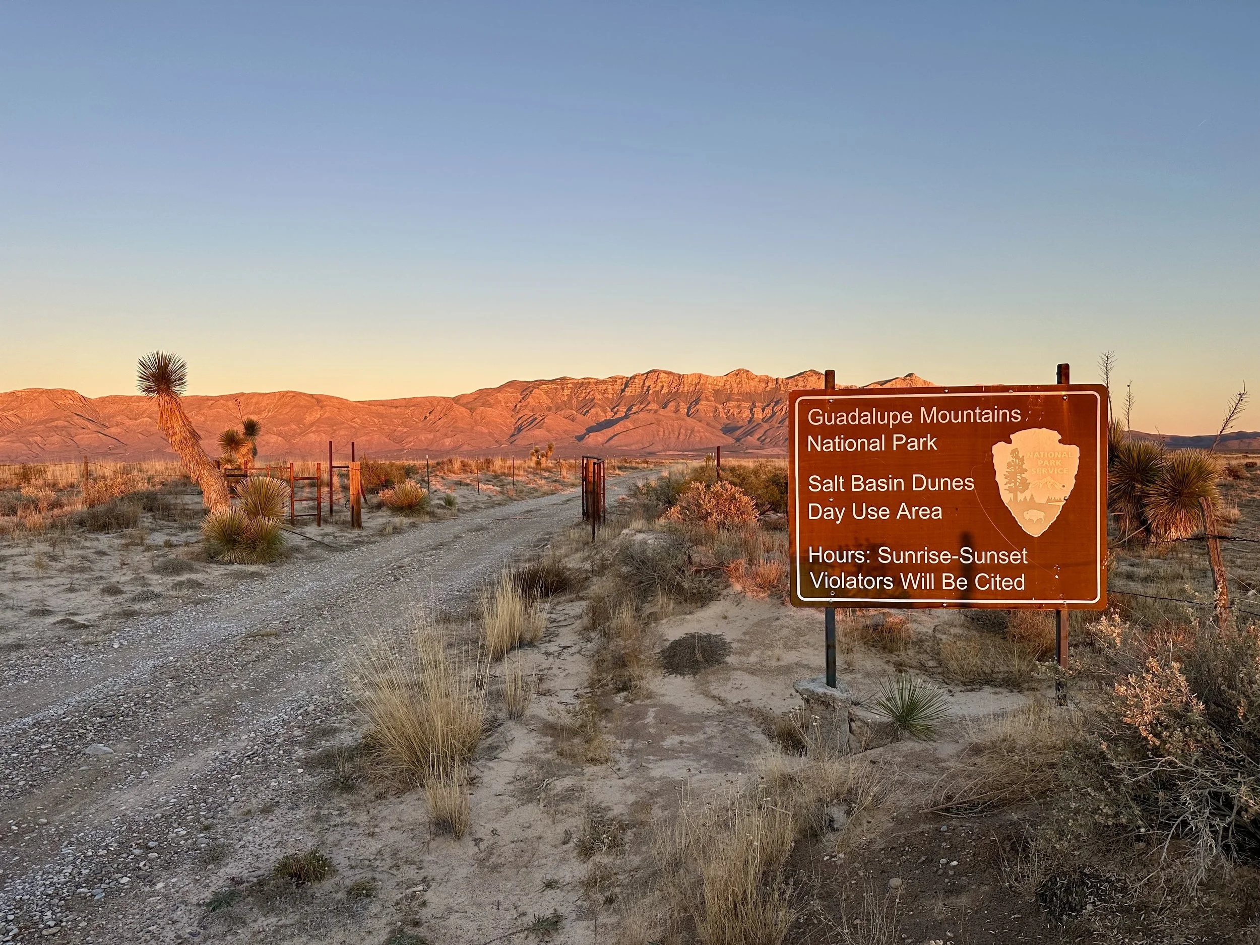
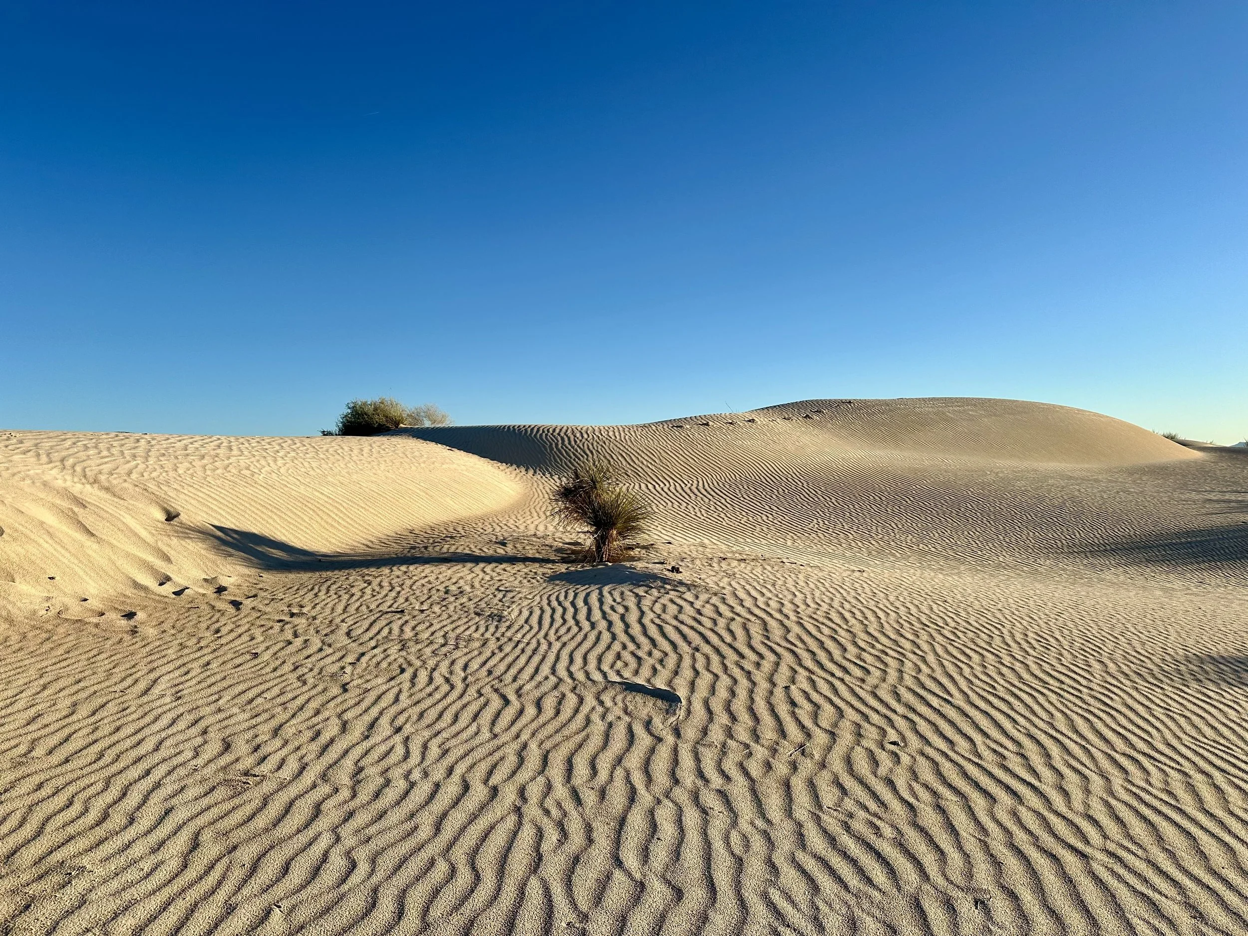
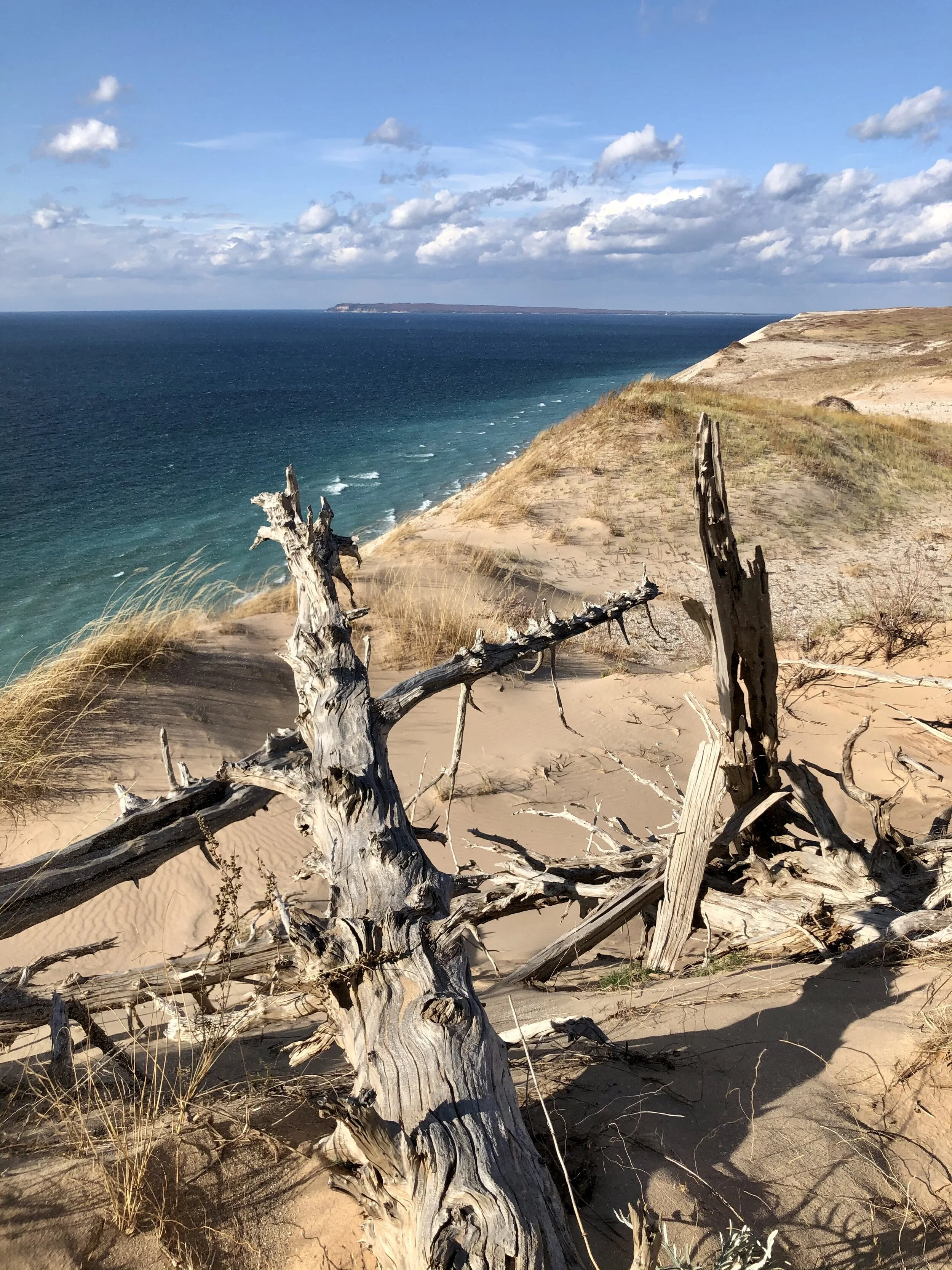
I decided to drive back toward El Paso afterward to avoid arriving after dark. About 45 minutes into the drive, I saw a sign for the Salt Basin Dunes and turned off out of curiosity. After 20 minutes on pavement and another 20–30 minutes on a dirt road, I arrived about an hour before sunset.
According to the park sign, most people take around 90 minutes to visit, but with daylight fading I opted for a fast run out to the dunes. I had the entire area to myself. The dunes are wide, clean, and silent, with mountains in the distance creating a dramatic backdrop. Running up and down the sand was a blast. I avoided the darker patches of ground—lichen that binds the sand—and stuck to the open lines. It was one of the most unexpected and memorable detours of the trip!
West Texas and southeastern New Mexico made for a surprisingly varied trip—caverns, mountains, dunes, and quiet desert towns all within a short drive of each other. Carlsbad was an easy base, the trails were memorable for both their beauty and their challenge, and the unexpected detours—like the Salt Basin Dunes and the old flume—ended up being some of the highlights. It’s a region that feels remote but approachable, and one that’s perfect for linking a few classic hikes with a bit of exploration.
Tracks
Gallery - Carlsbad, Texas


Gallery - Carlsbad Caverns