Highland Sky 40 Mile Ultramarathon - Davis, West Virginia
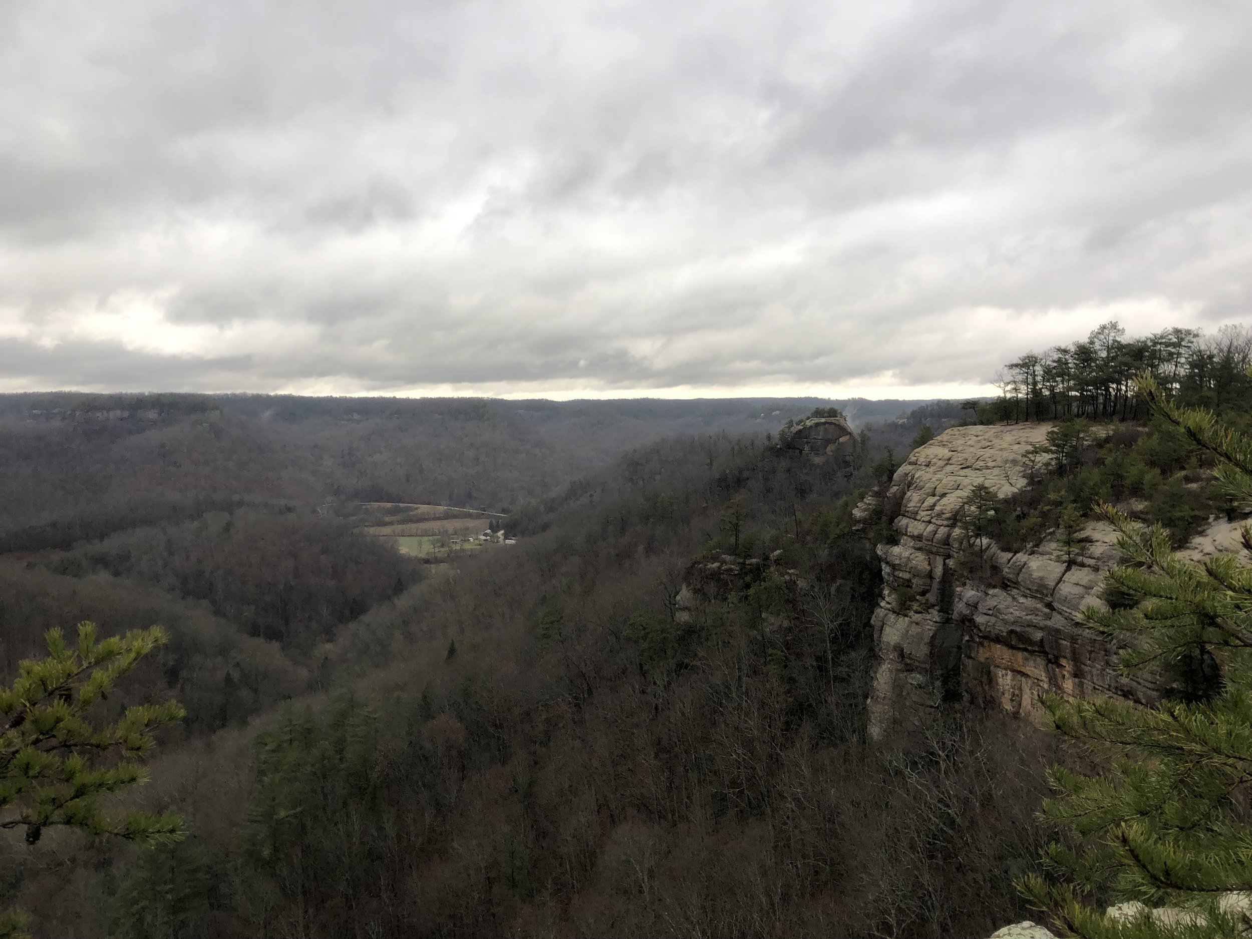
The Highland Sky 40 Miler ultramarathon course winds through West Virginia’s Monongahela National Forest, sections of the Timberline Ski Resort, Canaan Valley National Wildlife Refuge, and the Canaan Valley State Park. It is a great opportunity to experience the unusual ecosystem of the Dolly Sods, which is the highest plateau east of the Mississippi River, and the Roaring Plains. At times I felt like I was in a tropical wilderness and then in other places felt like alpine areas that I’ve experienced in other mountain terrain such as Mount Elbert in Colorado.
My trip started at 2:30pm in Columbus, Ohio and took a little over 4 and a half hours to drive to the Canaan Valley Resort & Conference Center. Google Maps showed two routes, with the non-interstate route being about 10 minutes faster. I wasn’t sure what the roads would be like, but was pleasantly surprised at how nice routes 33 and 50 are. The roads are very scenic, winding through the West Virginia mountains, and are mostly divided, high speed, highways.
I entered the resort’s main building and quickly found the race HQ. The registration was quick, and the hotel was alive with people milling about. I missed the pre-race briefing and dinner included in the registration fee, but I had also stopped for a Subway on the way in. When I got my bib, I double checked what time the buses would be leaving. They said the buses would leave at 5am sharp. I think in nearly every race I’ve done that involved a bus, the buses wouldn’t leave for about 20-30 minutes after the scheduled time. However, to my surprise, at this race, they left at 5am sharp, so don’t be late!
It was now about 8pm and it was my aim to be in bed by 9pm, so I headed straight for my hotel. On the way there I stopped at the convenience mart and got my go to fuel for an ultra: Pringles, 2 Twix bars, Gummi Bears and a liter of water. I crossed the street and checked in, which only took a minute. After prepping my backpack, laying out my clothes, and calling the family, it was time to sleep. I put in my earplugs, took two benadryl, and was out in an instant. I wasn’t sure where I was at 3:15am when my alarm went off, but I felt rested and ready to go. One trick I use when traveling since I like to have pop tarts and coffee in the morning is to get a couple of cans of cold brew coffee. I’d much rather microwave the cold brew coffee than use the in-room coffee machine since it’s hard to know how clean it is or what kind of coffee will be there.
The bus ride was only about 25 minutes to the start so we had about 30 minutes to hangout prior to the race start at 6 am. A point-to-point race like this is a special treat, even if it involves having to get up extra early for the bus ride. While standing around, I met someone who’d placed 6th the year before and finished in 7 hours. That time is even more impressive now knowing how tough this course is, especially the extremely rocky sections throughout at least half of it.
A few weeks ago I ran a 5k that had caused me to have a sore knot on my left shin. On Friday, I even debated whether I’d run the race, but decided that given the varied terrain and limited road running, I wouldn’t injure it any more. The thing with shin splint type injuries, at least in my experience, is that as long as you know it’s not a stress fracture, the pain subsides once you get started. However, you can never stop for long during the run or it’ll tighten up and be super painful to resume. Thankfully, this only happened once during the day when I spent a little too long at one of the aid stations. I also wore compression sleeves on my calves, which I hadn’t done for years, to keep my shins warm. These also turned out to be a great choice because they helped to keep from getting poked by the nettles thick along the trail.
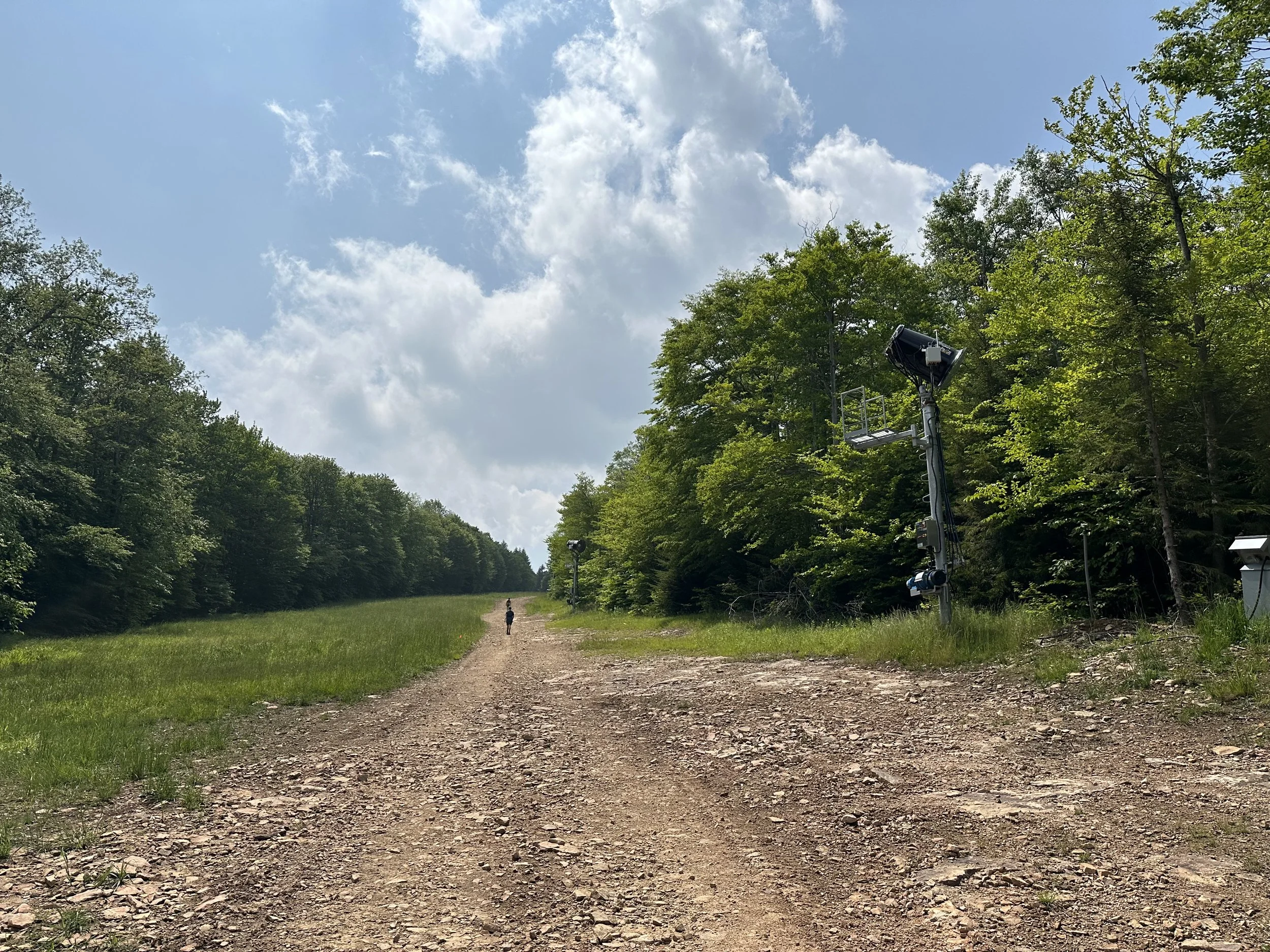
The course started on a road, and the pack went out very fast. This is because the leaders wanted to be first on the single track that winds up 2000 feet in the first 9 miles. There is then a 1500 feet descent over 5 miles, followed by a thousand foot ascent. Because of the elevation gain and extremely rocky terrain, I power walked most of these sections. Also, be prepared for a few stream crossings on very slippery rocks where you’ll fully submerge your feet. I wasn’t too far ahead of the cutoff when I finished the first two major climbs and knew I’d need to pick up the pace on the gravel section known as the “Road Across the Sky”. This gravel road was one of my most favorite parts of the course because the sun came out and it felt good to run the long gradual descents and power walk the ascents.
The beginning ascent and the final descent of the race were in dense forest. For the final descent, it was through a treed section off the back side of the Timberline Ski Resort with signs for “Gnarnia”. You get to this point after hiking up a ski slope and then taking a left turn into the forest. In this section, I saw several bike ramps in disrepair, and after some googling, it looks like the Timberline Bike Park was shut down in 2016 (at least that was their last post on Facebook). But, to give some sign of the challenge of this section, it was rated as a double black back course, which made for a lot of fun descending quickly through the trees on this winding trail. It was very runnable despite how steep it was, since the footing was good. Seeing old things like this is part of the fun of running a long distance race. You almost always come across something that doesn’t seem quite right that is interesting to research later. The Internet Archive Way Back Machine lets you see how the Timberline Resort page looked back in 2019.
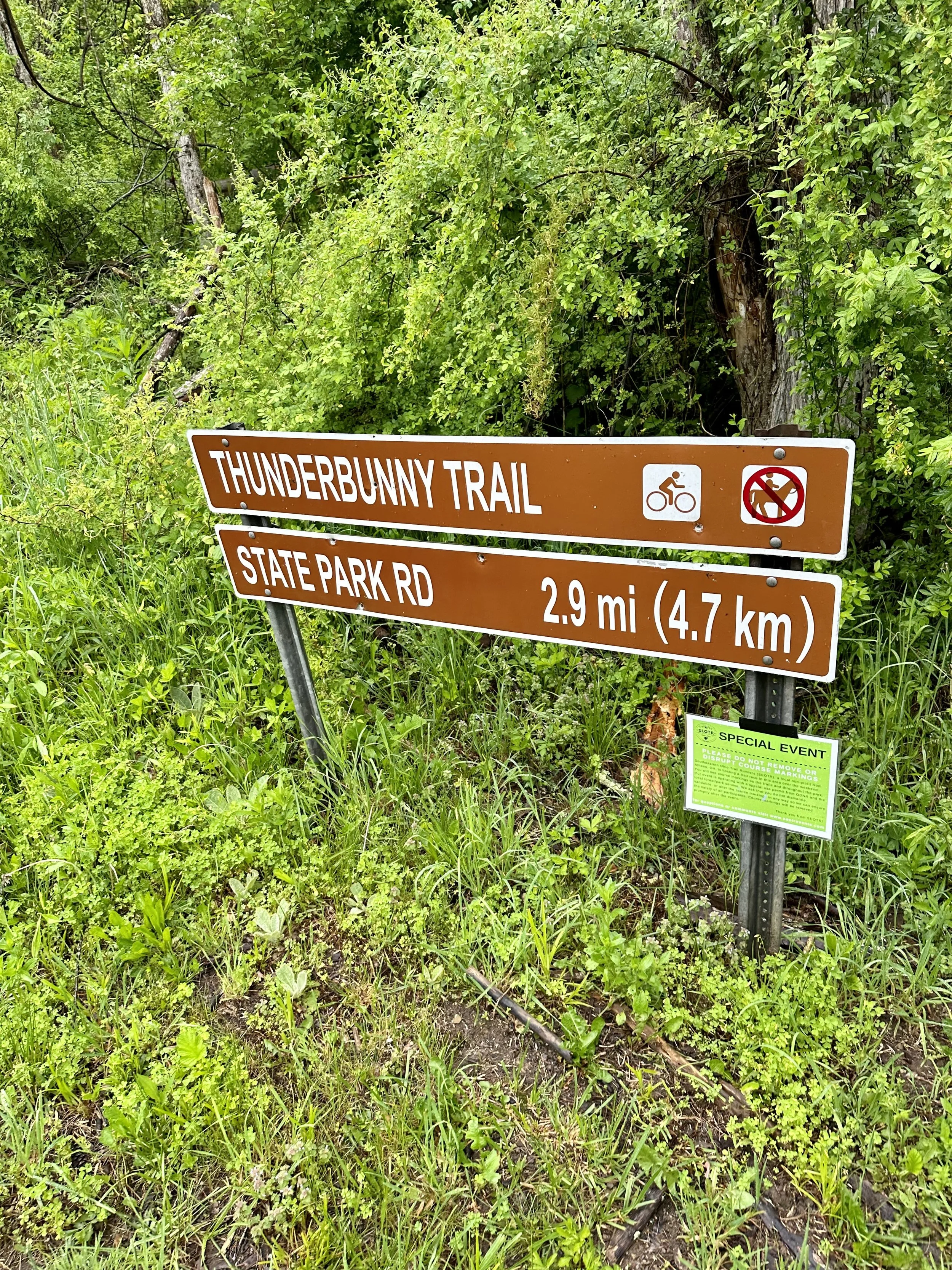
The most unusual part of the race is the portions at the highest point of the plateau and the meadows with wide open views. Much of the trail at the highest elevation is through a tunnel of foliage, where you cannot see too far ahead. It felt tropical in some sections, and high alpine like in others. In both areas, though, the trail was very rocky. Not the worst rock or scree I’ve seen, but for a non-technical runner like me, it slowed me down dramatically.
The Highland Sky 40 Miler is very accessible, being less than a 5 hour drive from a lot of metro areas in the midwest and mid-atlantic. If you register early, you can get a room at the Canaan Valley State Resort, or at the Inn at Canaan that is less than a 10 minute drive away from the resort. One benefit of the Inn at Canaan is there is a convenience store right across the street that has any last-minute items you might have forgotten. Parking is also plentiful at the resort, and the finish line is amazing, being right at the back of the main resort building in their outdoor event area.
This is a very well run race. Everything ran smoothly! The volunteers were exceptional, the course varied and unique, and the location isn’t too far, but still feels extremely remote. If you are interested, be sure to sign up right when registration opens as it books up in just days!
Track
Start: Red Creek Trailhead
End: Canaan Valley Resort & Conference Center
Distance: 41 miles (66km)
Elevation Gain: 5991 feet (1826m)